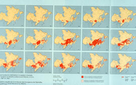
Item is a presentation drawing created by Drew Sperry of the urban context of a proposed YMCA for Halifax, which was Sperry's terminal design project for his Bachelor of Architecture degree at the Nova Scotia Technical College. His plan for the recreational complex is superimposed on to a map of Halifax.
A reproduction of the map "Coast of Acadie" by Lalanne, 1684, reproduced by the Archives du Service Hydrographique de la Marine, Paris in 1933 and used by William Inglis Morse in volume II of Acadiensia Nova in 1935.
Item consists of a hand-drawn, colour map of proposed changes to zoning of the Dalhousie University campus, dated December 2, 1965 and drawn by J. Edmonds. Includes proposals of rezoning several blocks from R-3 zone to Park and Institutional zone.
Item is a drawing of the proposed location of the former archives building (now the Chase Building) on Dalhousie University's Studley campus, showing ground elevations.
Item is a drawing showing the properties bordered by Bishop Street, Hollis Street, Salter Street, and Water Street in Halifax, Nova Scotia. The drawing shows all of the buildings that are located in this area, including the A. Keith & Son Ltd. building.
Item consists of a survey plan of the property owned by S. C. Oland on the corner of Pleasant Street and Central Street in Chester, Lunenburg County, Nova Scotia as surveyed by Errol Hebb.
Item consists of the plan of survey for the property owned by Richard H. Oland on Tremont Street in Chester, Nova Scotia and was surveyed by Kyle Harrington.
Item is a map of the harbour of present-day Halifax, Nova Scotia created in 1779 by Joseph-Bernard de Chabert. The map was commissioned by Antoine de Sartine. Depths shown by soundings.
Item consists of the plan of lands at Sackville, Nova Scotia owned by George W. C. Oland as surveyed by R. W. MacKenzie. The property was located between the Lucasville Road, Old Windsor Road, the new Windsor Road and Webber's Lake.
Item consists of a plan surveyed by G. G. Grant showing the where the Nova Scotia Power Corporation was to place the transmission line in the Brushy Hill - Lakeside area;
Item is a map of West Canada drawn and engraved by J. Rapkin. Illustrations on the map were drawn by H. Warren and engraved by Robert Wallis. The map was published in J. & F. Tallis' Illustrated atlas, and modern history of the World in 1851.
Item is a map showing the locations of the mill construction; ruins of the old brick kilns; the clay shed; the new brick kilns; pipe drying; power house and machinery department near the Park Road address.
Item is a map of East Canada and New Brunswick drawn and engraved by J. Rapkin. Illustrations on the map were drawn by H. Warren and engraved by Robert Wallis. The map was published in J. & F. Tallis' Illustrated atlas, and modern history of the World in 1851.
Item is a map of British America drawn and engraved by J. Rapkin. Illustrations on the map were drawn by H. Warren and engraved by Robert Wallis. The map was published in J. & F. Tallis' Illustrated atlas, and modern history of the World in 1851.
Item is a map of the Africville Area Land Ownership and Buildings, drawn by P.E.J. on July 26, 1962, for the Halifax City Planning Office, at a scale of 1" = 100'. Verso map also contains an inked list of property numbers, some crossed out and others checked off.
Item is a hand-coloured engraving of Cape Breton extracted from Atlas minimus, or, A new set of pocket maps of the several empires, kingdoms and states of the known world, published in 1758 by John Gibson and Emmanuel Bowen. The map appeared on page 46 of the book.
Item consists of an unattributed hand-drawn, colour map of the Dalhousie University campus, drawn in December 1962, titled "Ground Plan of Dalhousie University".
Item is map drawn by H.R. Theakston, University Engineer, showing Dalhousie and other associated buildings on and near both Studley Campus and Carleton Campus. The drawing includes a key indicating the names of both existing and proposed buildings. It was originally made on May 14, 1924 and revised on June 30, 1925.
Item is map drawn by H.R. Theakston, University Engineer, showing Dalhousie and other associated buildings on and near both Studley Campus and Carleton Campus. The drawing includes a key indicating the names of both existing and proposed buildings.
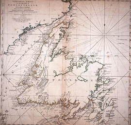
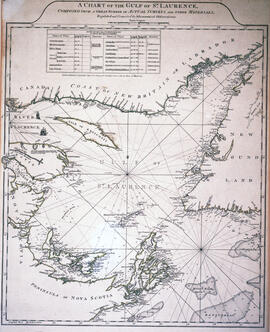
Item is a chart of the Magdalen Islands created by Thomas Jefferys. The chart was published in A Collection of Charts of the coasts of Newfoundland and Labrador (London 1765-1768). Item is entry 604 in Kershaw's Early printed maps of Canada.


![Proposed rezoning of lands as requested by Dalhousie College and University : [map]](/uploads/r/dalhousie-university-archives/8/6/1/861e617d5c96adf38c584d108c62d54870ae9f68c9c916a83c380a66ad409665/55aba0d1-efab-43d7-bbbd-aef7f5557f2a-UA-3_487_3_9_142.jpg)


![Ground plan of Dalhousie University : [map]](/uploads/r/dalhousie-university-archives/0/a/8/0a834f8be003875dbec4cda568fa7e0a24fae39ff5f4cfbb41c3d54d5495bd16/83655f0e-ef17-4831-90a0-73b6ffee38ca-UA-3_487_3_8_142.jpg)