Title and statement of responsibility area
Title proper
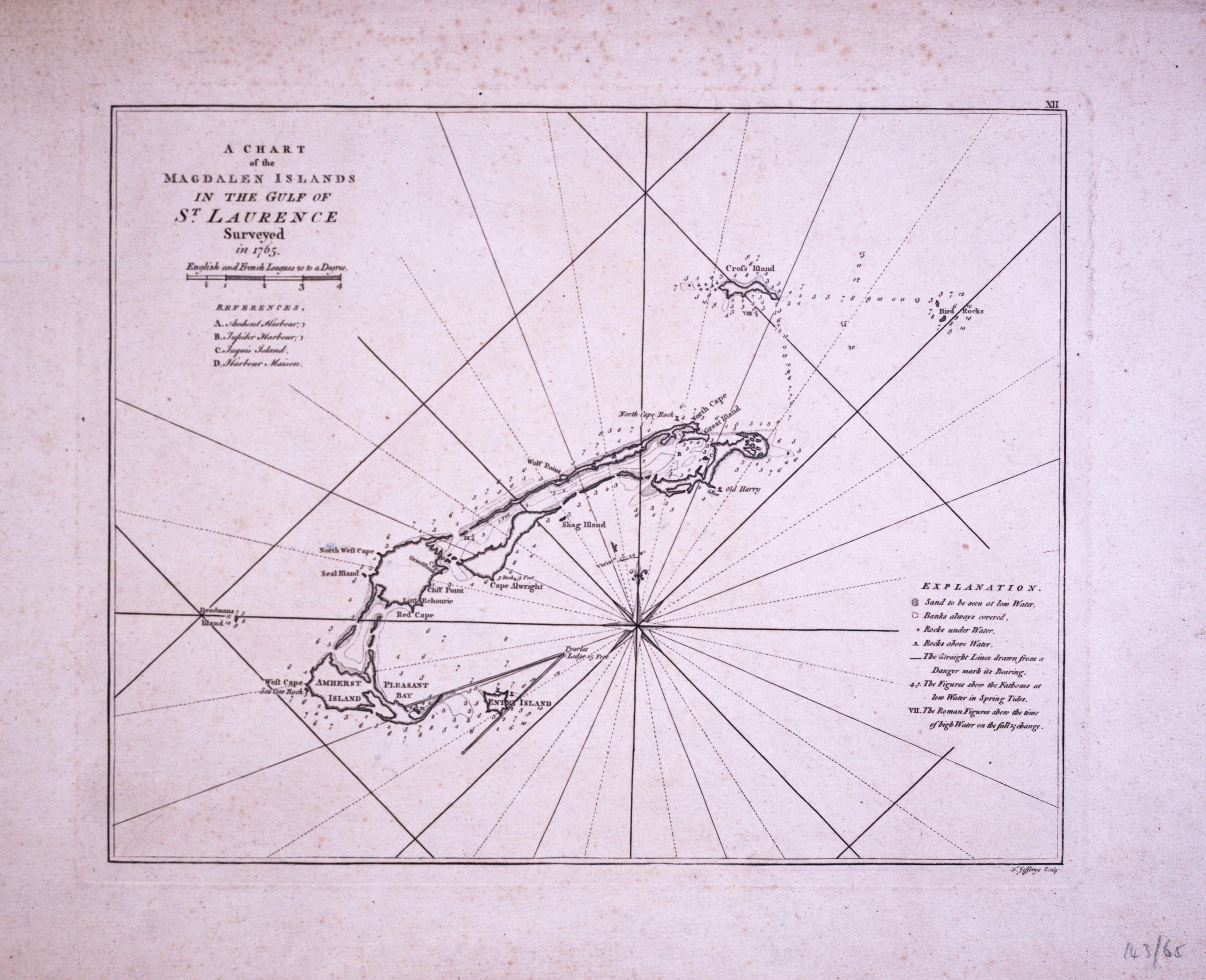
Chart of the Magdalen Islands in the Gulf of St. Lawrence, surveyed in 1765
General material designation
- Graphic material
Parallel title
Other title information
Title statements of responsibility
Thomas Jeffreys
Title notes
Level of description
Item
Repository
Reference code
MS-2-756, OS Folder 12
Edition area
Edition statement
Edition statement of responsibility
Class of material specific details area
Statement of scale (cartographic)
Statement of projection (cartographic)
Statement of coordinates (cartographic)
Statement of scale (architectural)
Issuing jurisdiction and denomination (philatelic)
Dates of creation area
Date(s)
-
[1799?] (Creation)
Physical description area
Physical description
1 chart : col., engraving ; 38 x 55 cm
Publisher's series area
Title proper of publisher's series
Parallel titles of publisher's series
Other title information of publisher's series
Statement of responsibility relating to publisher's series
Numbering within publisher's series
Note on publisher's series
Archival description area
Name of creator
(1905-1983)
Custodial history
Scope and content
Item is a chart of the Magdalen Islands created by Thomas Jefferys. The chart was published in A Collection of Charts of the coasts
of Newfoundland and Labrador (London 1765-1768). Item is entry 604 in Kershaw's Early printed maps of Canada.
of Newfoundland and Labrador (London 1765-1768). Item is entry 604 in Kershaw's Early printed maps of Canada.
Notes area
Physical condition
Immediate source of acquisition
Accession 2005-048
Arrangement
Language of material
- English