
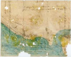
Plan of Studley Estate, site of Dalhousie University
- PC1, Box 31, Folder 26
- File
- 1878
Item is a photocopy of a plan of the Studley Estate in Halifax, Nova Scotia. The plan was copied from Hopkins Atlas, published 1878.
23 results with digital objects Show results with digital objects
Plan of Studley Estate, site of Dalhousie University
Research maps for Before Green Gables
Part of Budge Wilson fonds

Part of The Pullen Map Collection
Bellin, Jacques Nicolas, 1703-1772

Chart of the harbour of Halifax in Nova Scotia
Part of The Pullen Map Collection

Plan du port de Chibouctou à la côte de l'Acadie avec les côtes voisines
Part of The Pullen Map Collection

Map of Halifax Harbour outlining an area for possible development
Part of Oland and Son fonds
Part of Oland and Son fonds
Plan of survey of lands of Richard H. Oland, Tremont Street, Chester, Lunenburg County, Nova Scotia
Part of Oland and Son fonds
Part of Oland and Son fonds
Plan of survey for properties of Olands at Northfield, Hants County, Nova Scotia
Part of Oland and Son fonds
Part of Oland and Son fonds
Map of the lots on Atlantic-Acadia-Brussels streets belonging to J.E. Roy, 1911
Part of Hector McInnes fonds
Inness, Ronald Justin
Part of Ronald Justin Inness fonds
Records from the Joint Review Panel for the Whites Point Quarry and Marine Terminal Project
Part of Jill Grant fonds
Part of R. Graham Murray fonds
Records relating to the Antigonsh Harbour Mutual Telephone Company Ltd.
Records relating to the Baddeck Bridge Mutual Telephone Company Ltd.
Records relating to the Balls Creek Mutual Telephone Company Ltd.

Map of Broughton Mutual Telephone Company's telephone line

Transparency relief map of Sable Island
Part of Bill Freedman fonds
Ronald St. John Macdonald fonds
Macdonald, Ronald St. John, 1928-2006
Part of Ronald St. John Macdonald fonds
Sperry, Henry Drew

Dalhousie University grounds and buildings : erected and proposed
Part of Facilities Management
Site plans and maps of Studley campus
Part of Facilities Management
![Ground plan of Dalhousie University : [map]](/uploads/r/dalhousie-university-archives/0/a/8/0a834f8be003875dbec4cda568fa7e0a24fae39ff5f4cfbb41c3d54d5495bd16/83655f0e-ef17-4831-90a0-73b6ffee38ca-UA-3_487_3_8_142.jpg)
Ground plan of Dalhousie University : [map]
Part of President’s Office fonds
Part of Oland and Son fonds
Plans showing the property borders surrounding Lindwood Farms, Sackville, Nova Scotia
Part of Oland and Son fonds
Part of Oland and Son fonds
Plan showing Lot D1 of the Carl Hamilton property for transfer to Lindwood Farms
Part of Oland and Son fonds
Part of Bigelow family fonds
Part of Ronald St. John Macdonald fonds

Map of Beaver Bank Rural Telephone Company's telephone line
Records relating to the Abrierl Fisheries Telephone Company Ltd., Tangier Exchange
Records relating to the Alma Mutual Telephone Company Ltd.
Records relating to the Baileys Brook Mutual Telephone Company Ltd.
Records relating to the Barra Glen Mutual Telephone Company Ltd.
Dalhousie University campus maps
Part of Dalhousie University Class of 1931 - century package collection
Photographs of the flora, fauna, and buildings on Sable Island, Nova Scotia
Part of Bill Freedman fonds

Proposed location for the Archives building on Studley campus
Part of Facilities Management
Port de Louisebourg dans l'Isle Royale
Part of George Burden map collection
Bellin, Jacques Nicolas, 1703-1772
Part of George Burden map collection
Bowen, Emmanuel, 1694-1767
Maps of Lindbergh's flight across the Atlantic (signed by Charles Lindbergh, 1927)
Part of Robert A. Logan fonds
![Proposed rezoning of lands as requested by Dalhousie College and University : [map]](/uploads/r/dalhousie-university-archives/8/6/1/861e617d5c96adf38c584d108c62d54870ae9f68c9c916a83c380a66ad409665/55aba0d1-efab-43d7-bbbd-aef7f5557f2a-UA-3_487_3_9_142.jpg)
Proposed rezoning of lands as requested by Dalhousie College and University : [map]
Part of President’s Office fonds
Before Green Gables : research notes on Bible Hill and Onslow
Part of Budge Wilson fonds

Karte von dem Ostlichen-Stucke von Neu Frankreich oder Canada
Part of The Pullen Map Collection
Bellin, Jacques Nicolas, 1703-1772

Plan showing properties bounded by Bishop, Hollis, Salter & Water Streets
Part of Oland and Son fonds