
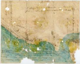
Chart of the harbour of Halifax in Nova Scotia
- MS-2-756, OS Folder 8
- Item
- 1775
Part of The Pullen Map Collection
19 results with digital objects Show results with digital objects
Chart of the harbour of Halifax in Nova Scotia
Part of The Pullen Map Collection

Dalhousie University grounds and buildings : erected and proposed
Part of Facilities Management

Dalhousie University grounds and buildings : erected and proposed
Part of Facilities Management
![Ground plan of Dalhousie University : [map]](/uploads/r/dalhousie-university-archives/0/a/8/0a834f8be003875dbec4cda568fa7e0a24fae39ff5f4cfbb41c3d54d5495bd16/83655f0e-ef17-4831-90a0-73b6ffee38ca-UA-3_487_3_8_142.jpg)
Ground plan of Dalhousie University : [map]
Part of President’s Office fonds
Hand-drawn map of Granville Street, Port Hawkesbury
Part of Christopher Heide fonds
Part of George Burden map collection
Bowen, Emmanuel, 1694-1767

Karte von dem Ostlichen-Stucke von Neu Frankreich oder Canada
Part of The Pullen Map Collection
Bellin, Jacques Nicolas, 1703-1772

Part of George Burden map collection
Randle, Charles, 1755-1813

Map of Musquodoboit Harbour Rural Telephone Company lines
Map of Nova Scotia or Acadia with the islands of Cape Breton and Saint John
Part of The Pullen Map Collection

Map of Petpeswick Harbour Mutual Telephone Company's telephone line
Part of Oland and Son fonds
Oland Estate : Plan of lands at Sackville, Nova Scotia, property of George W. C. Oland
Part of Oland and Son fonds

Part of The Pullen Map Collection
Bellin, Jacques Nicolas, 1703-1772

Plan du port de Chibouctou à la côte de l'Acadie avec les côtes voisines
Part of The Pullen Map Collection
Plan of survey of lands of Richard H. Oland, Tremont Street, Chester, Lunenburg County, Nova Scotia
Part of Oland and Son fonds
Part of Oland and Son fonds

Plan of the city and Harbour of Louisbourg
Part of The Pullen Map Collection

Plan showing properties bounded by Bishop, Hollis, Salter & Water Streets
Part of Oland and Son fonds
Port de Louisebourg dans l'Isle Royale
Part of George Burden map collection
Bellin, Jacques Nicolas, 1703-1772
Part of Bigelow family fonds

Proposed location for the Archives building on Studley campus
Part of Facilities Management
![Proposed rezoning of lands as requested by Dalhousie College and University : [map]](/uploads/r/dalhousie-university-archives/8/6/1/861e617d5c96adf38c584d108c62d54870ae9f68c9c916a83c380a66ad409665/55aba0d1-efab-43d7-bbbd-aef7f5557f2a-UA-3_487_3_9_142.jpg)
Proposed rezoning of lands as requested by Dalhousie College and University : [map]
Part of President’s Office fonds

Transparency map of continental shelf off Nova Scotia and Sable Island
Part of Bill Freedman fonds

Transparency relief map of Sable Island
Part of Bill Freedman fonds

Transparency relief map of Sable Island
Part of Bill Freedman fonds

Part of Drew Sperry fonds