Print preview Close

Showing 9 results

Archival Description
The Pullen Map Collection Image
Print preview View:

9 results with digital objects Show results with digital objects

Plan du port de Chibouctou à la côte de l'Acadie avec les côtes voisines
Chart of the Magdalen Islands in the Gulf of St. Lawrence, surveyed in 1765
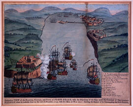
Perspective view of the harbour, coasts and town of Porto Bello
Karte von dem Ostlichen-Stucke von Neu Frankreich oder Canada
Plan of the city and Harbour of Louisbourg
Plan de la Baye de Chibouctou
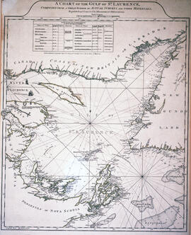
Chart of the Gulf of Saint Lawrence
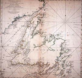
Chart of the Island of Newfoundland
Chart of the harbour of Halifax in Nova Scotia