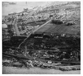
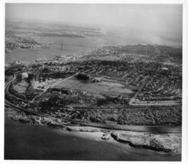
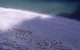
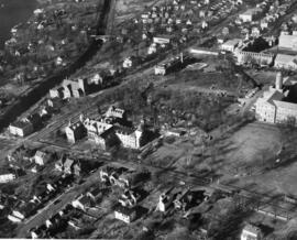
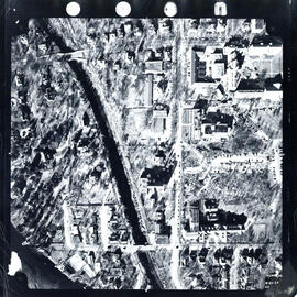
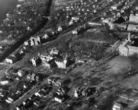
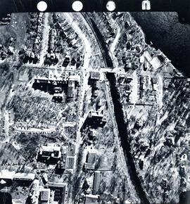
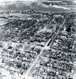
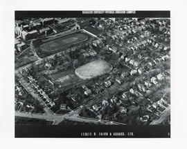
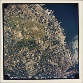
Item is an aerial photograph of Halifax's North End, including Africville. The photograph was used in Donald Clairmont's "Africville Relocation Report" ("'In' But Not 'Of' The City" pg. 3-20).
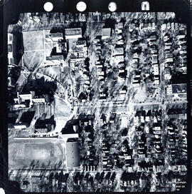
File contains two copies of an aerial photograph of Halifax's North End, including Africville. The photograph was used in Donald Clairmont's "Africville Relocation Report" ("'In' But Not 'Of' The City" pg. 3-20).
File contains two copies of an aerial photograph of Halifax's North End, including Africville. The photograph was used in Donald Clairmont's "Africville Relocation Report" ("'In' But Not 'Of' The City" pg. 3-20).
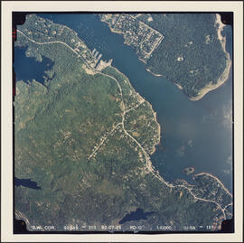
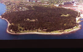
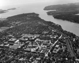
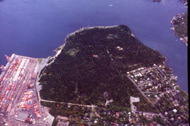
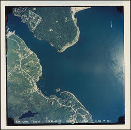
Item is an aerial photograph of the Northwest Arm and Point Pleasant Park, Halifax, on July 25, 1992. The photograph shows the coast of the Harbour approaches as far as Purcell's Cove.
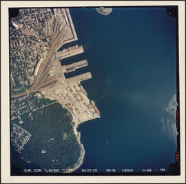
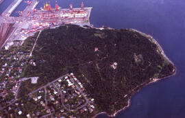
Item is an aerial photograph of Point Pleasant Park and the south end of Halifax, Nova Scotia taken on July 25, 1992. The photograph shows the campus of Saint Mary's University and the South End Container Terminal.
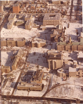
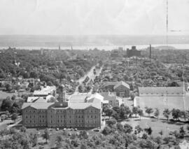
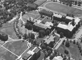
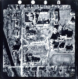
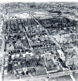
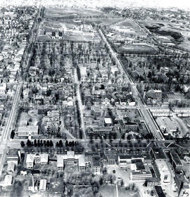
Item is an aerial photograph of Dalhousie University's Studley Campus, including Shirreff Hall, King's College, the Provincial Archives (Chase Building), Science Building (Chemistry Building), Arts Building (University Club), and Macdonald Library (Macdonald Building).
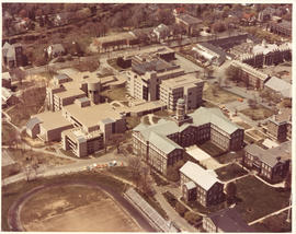
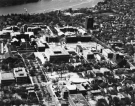
Item is an aerial photograph of Dalhousie University's Studley Campus, including the Life Sciences Centre and the Arts and Administration Building. The photograph was taken by SunDancer.
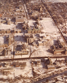
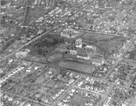
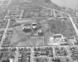
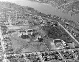
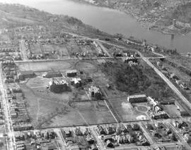
Item is an aerial photograph of the Carleton campus at Dalhousie University in the foreground of the image. The view looks north-east towards the MacDonald Bridge.
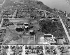
Item is an aerial photograph of the Carleton campus at Dalhousie University in the centre of the image. The view looks north-west towards the Northwest Arm.
Item is an aerial photograph of the Carleton campus at Dalhousie University in the centre of the image. The view looks south towards Point Pleasant Park.
Item is an aerial photograph of the Carleton campus at Dalhousie University in the centre of the image. The view looks east towards the Halifax Harbour.
Item is an aerial photograph of the Carleton campus at Dalhousie University. The photograph shows the Forrest Building and the Dentistry Building. File contains a duplicate of this image.
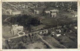
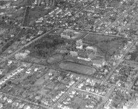
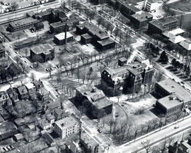
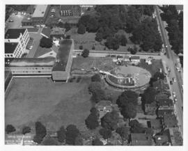
Item consists of two copies of an aerial photograph taken during the construction of the F. H. Sexton Memorial Gymnasium on Dalhousie University' Sexton Campus, formerly the Technical University of Nova Scotia.
Item is an aerial photograph of the Northwest Arm and Point Pleasant Park, Halifax, on July 25, 1992. The photograph shows the coast of the Harbour approaches south of Point Pleasant Park, as far as Ferguson's Cove.
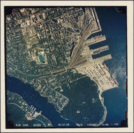
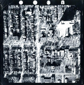
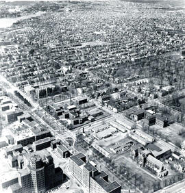
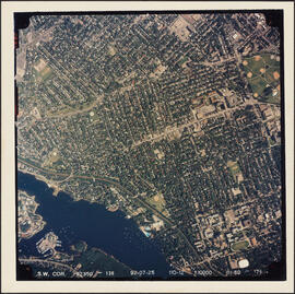
Item is an aerial photograph of the Halifax peninsula taken on July 25, 1992. The photograph shows downtown Halifax, the Halifax Common, the Halifax Citadel, and the Container Pier. The campus of Saint Mary's University is featured in the southern side of the photograph.
Item is an aerial photograph of the Halifax penninsula taken on July 25, 1992. The photograph shows West End and South End Halifax and part of the Halifax Common.