Cape Sable Island (N.S.)

Taxonomy

Code

43.458915, -65.605491 Map of Cape Sable Island (N.S.)

Scope note(s)

Source note(s)

  • Coordinates derived from http://www4.rncan.gc.ca/search-place-names/search?lang=en

Display note(s)

Hierarchical terms

Cape Sable Island (N.S.)

Cape Sable Island (N.S.)

Equivalent terms

Cape Sable Island (N.S.)

Associated terms

Cape Sable Island (N.S.)

3 Archival Description results for Cape Sable Island (N.S.)

3 results directly related Exclude narrower terms

Photograph of a man looking at a hole in the keel of a salvaged boat, sitting on a beach at Seal Island with a small crowd of people amassed to observe

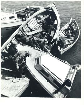
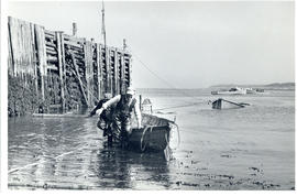
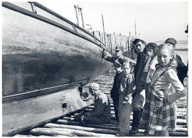
Item is a photograph of a salvaged boat. The hole in its keel was sustained by striking a piece of steel. An American ship went aground between Seal Island and Blonde Rock during World War II, and steel cargo was thrown overboard in an effort to lighten the vessel for subsequent salvage operations. The ejected steel remains a menace to fishing boats in those waters, where the tide rises and falls with a large margin.