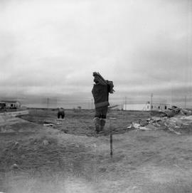
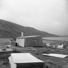
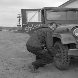
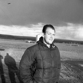
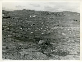
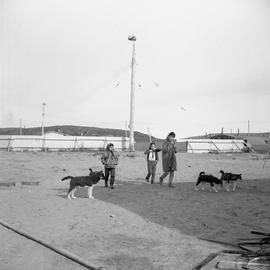
Québec

42 Archival Description results for Québec

Only results directly related

Hudson Strait

File contains a map of the Hudson Strait, including northern Quebec, Baffin Island, Ungava Bay, and Hudson Bay. The map shows the soundings in fathoms for this area. There is a patch attached to the centre of the map, either to repair a hole or to make a correction.

Information about the Avataq Cultural Institute and other material

File contains an annual report from the Avataq Cultural Institute; issue 5 of Tumivut, the cultural magazine of the Nunavik Inuit; a booklet called "Eskimo Graphic Art"; two copies of a print of a raccoon by F. S. Ellis; a resolution from the Avataq Cultural Institute; and information about the Avataq history project. The file also includes correspondence with Brian Mulroney; the office of the Minister of Indian and Northern Affairs Canada; and Jenny Epoo of the Avataq Cultural Insitute Inc.

Photograph of a man looking through a telescope

Item is a photograph of a young man wearing a coat with fur trim on the hood and rickrack trim on the sleeves. The young man is looking through a telescope. The photograph was taken somewhere in northern Quebec.

Photograph of a man looking through a telescope

Item is a photograph of a young man wearing a coat with fur trim on the hood and rickrack trim on the sleeves. The young man is looking through a telescope. The photograph was taken somewhere in northern Quebec.

Photograph of Gordon Braley in northern Quebec

Item is a photograph of a bush pilot named Gordon Braley who is wearing a dark-coloured jacket. The photograph was taken in northern Quebec, possibly in Wakeham Bay or Fort Chimo.

Photograph of three girls walking with four dogs in northern Quebec

Item is a photograph of three unidentified girls walking across a patch of sand. There are four dogs walking with them. There is a transmission tower behind them as well as the boundary boards of an ice rink. The photograph was taken somewhere in northern Quebec, probably in Fort Chimo.

Photograph of two puppies outdoors in Northern Quebec

Item is a photograph of two puppies roaming outdoors somewhere in Northern Quebec. One puppy is light-coloured and has short hair and the other puppy is black and white with fluffy hair. The puppies are near some small buildings and an ice rink.

Photographs from trip to eastern Arctic

File contains photographs taken by Rosemary Gilliat during a trip to the eastern Arctic with Barbara Hinds. The photographs were taken in Ungava Bay, Koksoak River, Ikaluk, Frobisher Bay, Port Burwell, and Cape Dorset. They include photographs of Barbara Hinds, Rosemary Gilliat, Bill Lamour, Eetuk, Pitsolak, Stan Annanak, hunters, and a polar bear. There are captions written on the backs of the photographs.

Eaton, Rosemary C. (Gilliat)

Recording of an interview with Major Longan and other recordings

File contains a reel-to-reel recording of Barbara Hinds' interview with Major Jess O. Longan (or Louyan); bushpilot Ken Dempster playing the melodion; Barbara Hinds' interview with Mr. Page about a laundry in Frobisher Bay; Barbara Hinds talking about a journey by boat near Rupertsland; and the sound of the wind.

Ressources du nord du Quebec

File contains a map of the resources of northern Quebec. The map indicates the predominant species across the province, sites of mineral resources, sites of hydraulic resources, First Nations and Inuit communities, and airports or other routes for transportation.

Slides from northern Quebec and other locations

File contains 73 slides taken in northern Quebec in 1965 and 1966. The photographs were taken in Fort Chimo, Sugluk, Ivujivik, Deception Bay, Povungnetuk, and other locations in northern Quebec, although most slides are not labeled with locations. The photographs show residents of these places, the surrounding landscapes, aerial views, buildings, and boats. The file also contains slides from other dates that may have been taken in Halifax or in other locations.