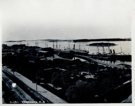
Photograph of the Yarmouth waterfront taken by aerial
- MS-2-202, Box 51, Folder 30, Item 2
- Item
- [ca. 1933]
Part of Thomas Head Raddall fonds
Photograph of the Yarmouth waterfront taken by aerial
Part of Thomas Head Raddall fonds
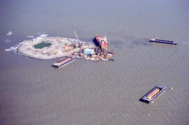
Aerial photograph of Immerk artificial island, Mackenzie Bay, Northwest Territories
Part of Bill Freedman fonds
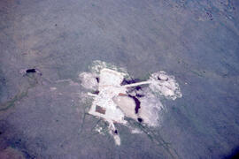
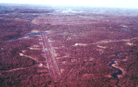
Aerial photograph of an old oil rig drilling site, Mackenzie River delta, Northwest Territories
Part of Bill Freedman fonds
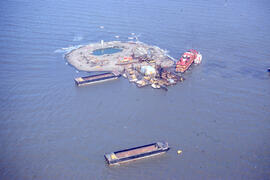
Aerial photograph of Immerk artificial island, Mackenzie Bay, Northwest Territories
Part of Bill Freedman fonds
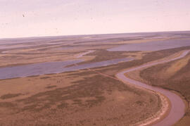
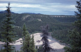
Aerial photograph of the Mackenzie River delta, near Tuktoyaktuk, Northwest Territories
Part of Bill Freedman fonds
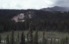
Aerial photograph of the O'Donnell Roast Bed, southwest of Sudbury, Ontario
Part of Bill Freedman fonds
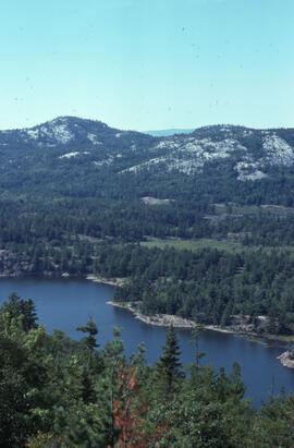
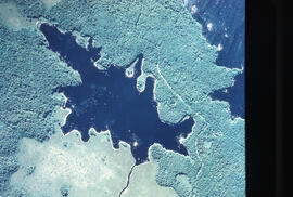
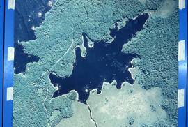
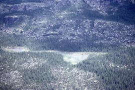
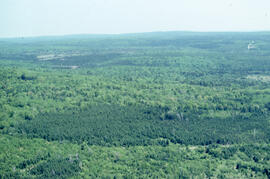
Aerial photograph of a lake in Killarney Provincial Park, near Sudbury, Ontario
Part of Bill Freedman fonds
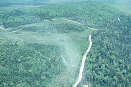
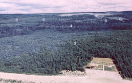
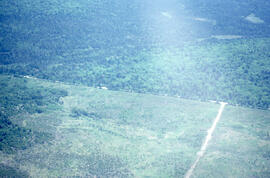
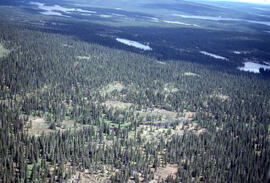
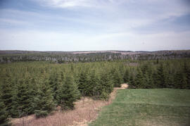
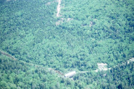
Aerial photograph showing the boundary between an Irving forest plantation and Fundy National Park
Part of Bill Freedman fonds
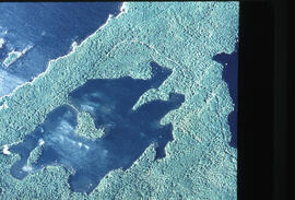
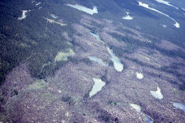
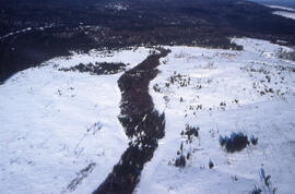
Aerial photograph of Pebbleloggitch Lake, Kejimkujik National Park, Nova Scotia
Part of Bill Freedman fonds
Part of Bill Freedman fonds
Part of Bill Freedman fonds
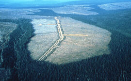
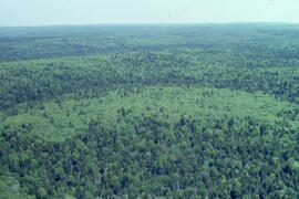
Aerial photograph of a large forested plot before spraying
Part of Bill Freedman fonds
Aerial photograph of large forested plot before spraying
Part of Bill Freedman fonds
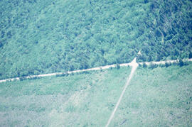
Aerial photograph of the Fundy National Park boundary
Part of Bill Freedman fonds
Aerial photograph of a young pingo on the Tuktoyaktuk Peninsula
Part of Bill Freedman fonds
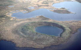
Aerial photograph of a collapsed pingo on the Tuktoyaktuk Peninsula, Northwest Territories
Part of Bill Freedman fonds
Aerial photograph of a patterned rocky fen near Postville, Newfoundland and Labrador
Part of Bill Freedman fonds
Part of Bill Freedman fonds
Part of Bill Freedman fonds
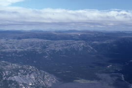
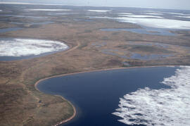
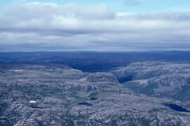
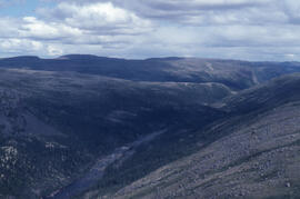
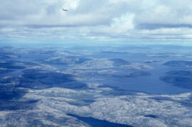
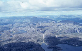
Aerial photograph of headlands and landscape around Voisey's Bay, Newfoundland and Labrador
Part of Bill Freedman fonds
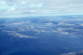
Aerial photograph of headlands and landscape around Voisey's Bay, Newfoundland and Labrador
Part of Bill Freedman fonds
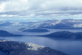
Aerial photograph of headlands and landscape around Voisey's Bay, Newfoundland and Labrador
Part of Bill Freedman fonds
Aerial photograph of headlands and landscape around Voisey's Bay, Newfoundland and Labrador
Part of Bill Freedman fonds
Aerial photograph of headlands and landscape around Voisey's Bay, Newfoundland and Labrador
Part of Bill Freedman fonds
Part of Bill Freedman fonds
Aerial photograph of the Fraser River canyon, near Voisey's Bay, Newfoundland and Labrador
Part of Bill Freedman fonds
Part of Bill Freedman fonds
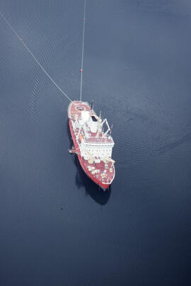
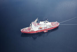
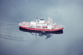
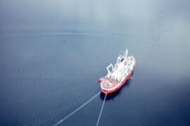
Aerial photograph of the accommodation ship Franklin in Voisey's Bay, Newfoundland and Labrador
Part of Bill Freedman fonds
Aerial photograph of the accommodation ship Franklin in Voisey's Bay, Newfoundland and Labrador
Part of Bill Freedman fonds
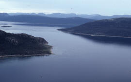
Aerial photograph of the coastline around Voisey's Bay, Newfoundland and Labrador
Part of Bill Freedman fonds
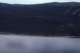
Aerial photograph of dense forested landscape around Voisey's Bay, Newfoundland and Labrador
Part of Bill Freedman fonds
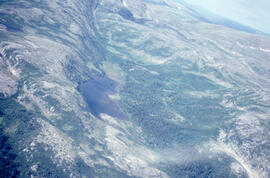
Aerial photograph of basin fenland near Voisey's Bay, Newfoundland and Labrador
Part of Bill Freedman fonds
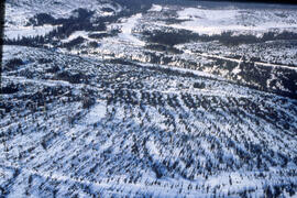
Aerial panoramic photograph of the snow-covered forest near Voisey's Bay, Newfoundland and Labrador
Part of Bill Freedman fonds
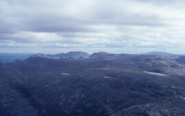
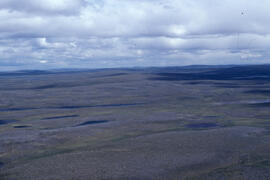
Aerial photograph of upland tundra and the Voisey Bay coastline, Newfoundland and Labrador
Part of Bill Freedman fonds
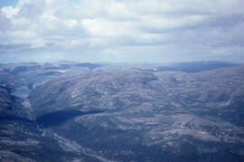
Aerial photograph of upland tundra and the Voisey Bay coastline, Newfoundland and Labrador
Part of Bill Freedman fonds
Aerial photograph of upland tundra and the Voisey Bay coastline, Newfoundland and Labrador
Part of Bill Freedman fonds
Aerial photograph of upland tundra near Voisey's Bay, Newfoundland and Labrador
Part of Bill Freedman fonds
Aerial photograph of the accommodation ship Franklin in Voisey's Bay, Newfoundland and Labrador
Part of Bill Freedman fonds
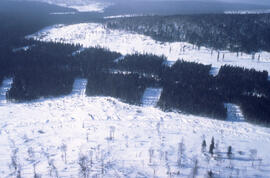
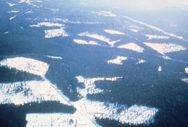
Aerial photograph of clear cuts and strip cuts in a deer wintering area, northern New Brunswick
Part of Bill Freedman fonds
Aerial photograph of forestry cut overs in northern New Brunswick
Part of Bill Freedman fonds
Aerial photograph of a clear cut with a buffer zone, northern New Brunswick
Part of Bill Freedman fonds
Aerial photograph of clear cuts in a deer wintering area, northern New Brunswick
Part of Bill Freedman fonds
Aerial photograph of clear cuts in nothern New Brunswick
Part of Bill Freedman fonds
Aerial photograph of clear cuts near Nepisiguit River, northern New Brunswick
Part of Bill Freedman fonds
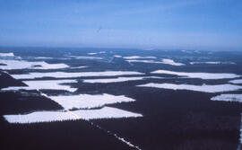
Aerial photograph of clear cuts and cutovers in northern New Brunswick
Part of Bill Freedman fonds
Part of Bill Freedman fonds
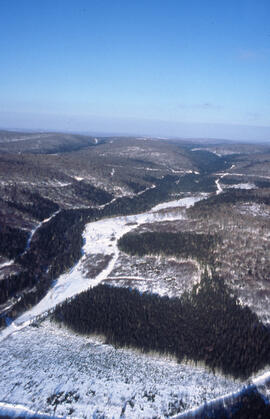
Aerial photograph showing the Fundy National Park boundary
Part of Bill Freedman fonds
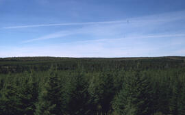
Aerial photograph of a dense natural forest landscape in Fundy National Park, New Brusnwick
Part of Bill Freedman fonds
Aerial photograph of a covered bridge in Fundy National Park, New Brunswick
Part of Bill Freedman fonds
Aerial photograph of a regenerating plantation near Fundy National Park, New Brunswick
Part of Bill Freedman fonds