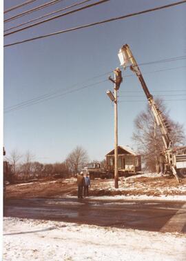
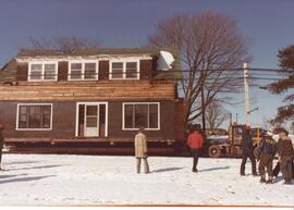
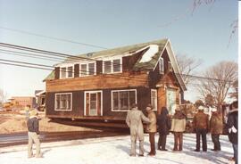
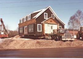
Item is a photograph of a house being moved off the NSAC campus, it's on a flat bed truck. People are adjusting the lines along College Road. It was located near the MacRae Library on College Road, moved to the corner of College Road and Wright Avenue in 1982.
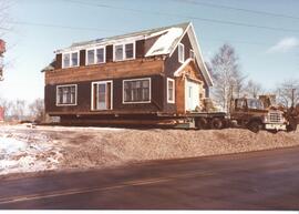
Item is a photograph of a house being moved off the NSAC campus, it's on a flat bed truck. The MacRae Library is located in the background. It was located near the MacRae Library on College Road, moved to the corner of College Road and Wright Avenue in 1982.
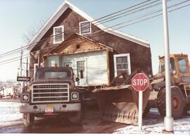
Item is a photograph of a house being moved off the NSAC campus, it's on a flat bed truck. It is parked near a stop sign and there is a front loader parked near by. It was located near the MacRae Library on College Road, moved to the corner of College Road and Wright Avenue in 1982.
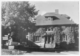
Item is a photograph of a house being moved off the NSAC campus. It was located near the MacRae Library on College Road, moved to the corner of College Road and Wright Avenue in 1982.
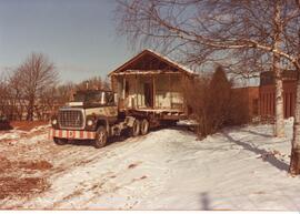
Item is a photograph of a house being moved off the NSAC campus, it's on a flat bed truck. It was located near the MacRae Library on College Road, moved to the corner of College Road and Wright Avenue in 1982.
Item is a photograph of a house being moved off the NSAC campus. It was located near the MacRae Library on College Road, moved to the corner of College Road and Wright Avenue in 1982.
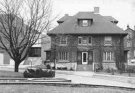
Item is a photograph of a house being moved off the NSAC campus. It was located near the MacRae Library on College Road, moved to the corner of College Road and Wright Avenue in 1982. The MacRae Library (under construction) is visible behind the house.
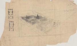
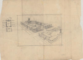
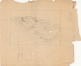
Item is map drawn by H.R. Theakston, University Engineer, showing Dalhousie and other associated buildings on and near both Studley Campus and Carleton Campus. The drawing includes a key indicating the names of both existing and proposed buildings. It was originally made on May 14, 1924 and revised on June 30, 1925.
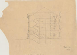
Item is an unsigned drawing labelled "Dal Arts / 282" showing a cross section of staircases and including measurements for treads, and ceiling heights. It's part of a series of drawings made by Andrew Cobb for an arts building at Dalhousie that was planned but never built.
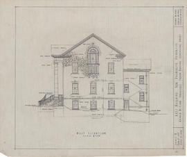
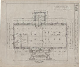
Item is sheet no. 7 of an original set of ten construction drawings of Dalhousie's arts building (now the University Club), which was built on Studley Campus in 1921. The west elevation was drawn by A.M.K, traced by P.K.A. and checked by A.R.C. (Andrew R. Cobb).
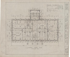
Item is sheet no. 3 of an original set of ten construction drawings of Dalhousie's arts building (now the University Club), which was built on Studley Campus in 1921. The second floor plan was drawn by A.M.K, traced by P.K.A. and checked by A.R.C. (Andrew R. Cobb).
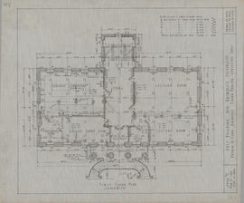
Item is sheet no. 2 of an original set of ten construction drawings of Dalhousie's arts building (now the University Club), which was built on Studley Campus in 1921. The first floor plan plan was drawn by A.M.K, traced by P.K.A. and checked by A.R.C. (Andrew R. Cobb).
Item is sheet no. 1 of an original set of ten construction drawings of Dalhousie's arts building (now the University Club), which was built on Studley Campus in 1921. The basement plan was drawn by A.M.K, traced by P.K.A. and checked by A.R.C. (Andrew R. Cobb).
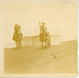
Item consists of a photograph of two unidentified people on horseback, in front of the refuge hut, described as being "east of east light" on Sable Island.
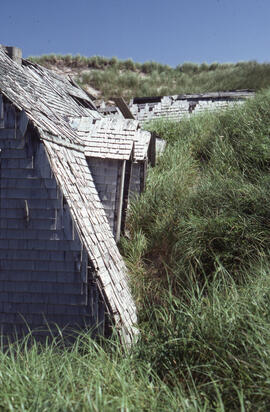
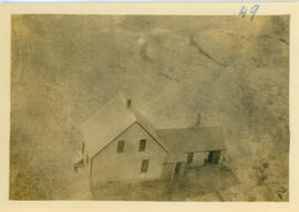
Item consists of a photograph of a building on Sable Island -- likely the old schoolhouse -- prior to its being overtaken by encroaching sand, probably taken in 1918.
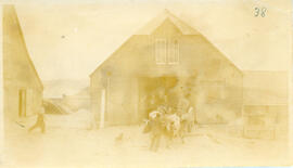
Item consists of a photograph of three unidentified people examining sections of the stack for use in the construction of the new western lighthouse on Sable Island, taken either late 1917 or early 1918.
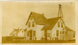
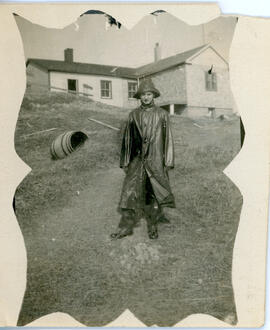
Item consists of a photograph of a person wearing waterproof gear standing in front of the wireless station on Sable Island after the construction of the building's extension was completed in 1918.
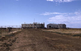
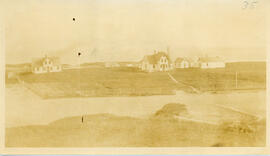
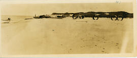
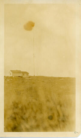
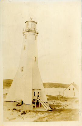
Item consists of a photograph of the station located at the new western lighthouse on Sable Island, taken from atop that lighthouse, likely in early 1918.
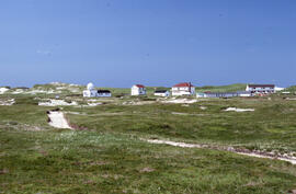
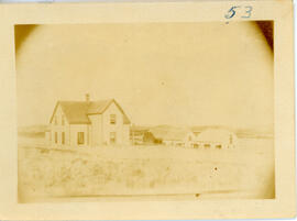
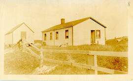
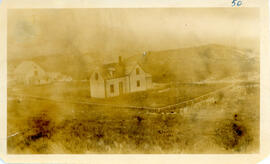
Item consists of a photograph of two buildings on Sable Island inside a fenced enclosure -- presumed by Richard Orme Allen to be Station Number 2 -- taken likely in 1917.
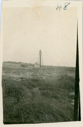
Item consists of a photograph taken in 1917 of West Light on Sable Island, prior to its decommissioning at the end of 1917, The lighthouse was originally constructed in this form in 1888.