File contains 215 photographs taken by Bill Freedman at a variety of locations, including Aylesford Lake, NS, and Halifax County, between 1980 and 1995. Photographs show experimental and conventional clear-cutting examples at Aylesford Lake, Nova Scotia; advanced regeneration after a burn near Herring Cove, Nova Scotia; views of Pebbleloggitch Lake, Kejimkujik National Park; different rates of growth of trees of different ages; felling, bucking and sorting of Acer saccharum, and examples of throughfall and stemflow. Also includes examples of herbicide efforts.
File contains 73 photographs taken by Bill Freedman at the sites of small, controlled, experimental oil spills near Tuktoyaktuk (Pingo, Point, Meadow, Lupin), predominantly from 1973 and 1974. Also includes some photos from similar experiments at Cape Parry. Photographs document experimentation of regrowth of vegetation in response to small-scale oil spills.
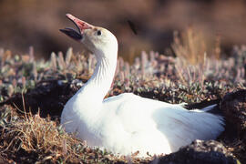
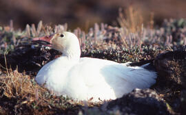
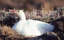
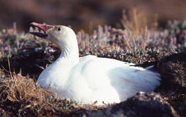
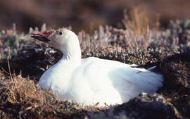
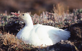
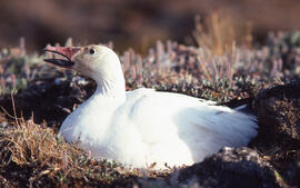
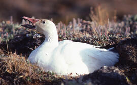
File contains 51 photographs taken by Bill Freedman from locations around Tuktoyaktuk, Northwest Territories, between 1973 and 1986. Photographs show plants of the region.
File contains 37 photographs taken by Bill Freedman in the vicinity of Tuktoyaktuk, NT, in 1986. Photographs document experimentation of regrowth of vegetation in response to small-scale oil spills, at the Split Pingo spray plot and Meadow spill sites.
File contains 116 photographs taken by Bill Freedman in the region around Sudbury, Ontario, between 1975 and 1986, as part of his thesis fieldwork. Photographs show slag heaps, roast beds, pollution, plant damage, and mining infrastructure from the Copper Cliff, Coniston, and Falconbridge sites near Sudbury, and flora at the nearby Wanapitei River, Richard Lake, and Burwash sites.
File contains 11 photographs taken by Bill Freedman, Luc Foisy, Todd Keith, and J. Pleau, between 1990 and 1997. Photographs show forest fire damage at the "Aire G" site at La Mauricie National Park in the Laurentians, Quebec, and near Dawson City, Yukon, as well as burn recovery at Banff National Park and northern New Brunswick.
File contains 36 photographs taken by Bill Freedman in the area around Sudbury, Ontario, between 1975 and 1986 (many of which were used as part of his thesis fieldwork). Photographs show tailings ponds, nickel runs, roast beds, and slag pouring at the Coppercliff, Burwash, Coniston, Richard Lake, and Falconbridge sites.
File contains 6 photographs taken by Bill Freedman in the Great Lakes and at Lake Winnipegosis, Manitoba, in the early-1980s. Photographs show the effects of pollution of Double-crested cormorant chicks, including examples of "addled embryos".
File contains 40 photographs taken by Bill Freedman at Brier Island, Digby County, Nova Scotia, in 1984. Photographs show glyphosate herbicide spraying of forests by helicopter. There are also several photographs of researchers at Northern Light.
File contains 6 photographs taken by Roger Belanger (and collected by Bill Freedman), likely in 1970. Photographs show clean-up efforts after the oil spill after the SS Arrow ran aground during a gale, in Chedabucto Bay, February 4, 1970.
File contains 16 photographs taken by Bill Freedman, predominantly in 1975. Photographs show birds and plants at two Newfoundland parks: Cape St. Mary's Reserve on the Avalon Peninsula, and Gros Morne on the Great Northern Peninsula.
File contains 25 photographs taken, largely by Bill Freedman, in Gros Morne National Park and along the Churchill River, Labrador, between 1998 and 2001. There are also photos by fellow researchers Annette Lutterman and Todd Keith. Photographs depict plants in Gros Morne and the Churchill River area, dried riverbeds above Churchill Falls, and three photos of Innu residents of the area.
File contains 58 photographs taken by Bill Freedman at Voisey's Bay, Labrador, in 1996. Photographs show river rapids, aerial surveys of the region, Fraser River Canyon, and some ground vegetation, near the site of the nickel mining operation. Late in 1996, Inco acquired rights to mine nickel from the area, and Freedman's visit involved conducting an environmental assessment (which he had done previously for nickel mining sites in Sudbury, Ontario).
File contains 12 photographs taken by Bill Freedman near Corner Brook, Newfoundland, in 1992. Photographs show forestry operations and equipment (grapple yarders, and skidders), and evidence of deforestation in the area.
File contains 108 photographs taken by Bill Freedman at three sites in Nova Scotia between 1983 and 1990. Photographs show glyphosate herbicide spraying at Antrim, Halifax County, the "Riverside" site (possibly along the Shubenacadie River, Hants County), and Little RIver Lake, Kings County.
File contains 86 photographs taken by Bill Freedman in Fundy National Park, New Brunswick, between 1990 and 1998. Photographs show clear-cutting of trees damaged by spruce beetle, as well as Irving-driven regrowth and plantation efforts.
File contains 45 photographs taken by Bill Freedman on a hiking trip along the Gaff Point trail in Lunenburg County, Nova Scotia, in 2001. Photographs show trees in the area, as well as coastal scenes.
File contains 22 photographs taken by Bill Freedman between 1989 and 2001. Photographs show vegetation at the Murchyville bog (near Moose River, Nova Scotia), a Christmas tree lot in Lunenburg County, the barrens at Polly Cove (Halifax County), and examples of the endangered Geum peckii on Brier Island (Digby County).
File contains 28 photographs taken by Bill Freedman near the Tufts Cove Generating Station, Dartmouth, Nova Scotia, in August 1989. Photographs show damage to vegetation (Red oak, pumpkin, cucumber, and tomato) potentially caused by the accidental emission of acidic particulates from the generating station.
File contains 51 photographs taken by Bill Freedman in the Postville area of Labrador, between 1975 and 1977 (predominantly 1977). Photographs show geological formations, bogs, and flora around the Michelin Lake area near Postville. File also contains some photographs of flora taken at Terra Nova National Park
File contains 68 photographs taken largely by Bill Freedman (but also by Sweeney) at Point Pleasant Park, Halifax, Nova Scotia, in 2000. Photographs show aerial and up-close examples of the destruction wrought on the urban park by the invasive Brown spruce longhorn beetle, believed to arrive in the city via the nearby port.
File contain 58 photographs taken by Bill Freedman in 2003. Photographs show aerial surveys of the forests, understory, and invertebrate species of the Tobeatic Wilderness Area in southwestern Nova Scotia as well as the southwestern coast of Nova Scotia in general.
File contains 25 photographs taken by Bill Freedman near Barrington, Nova Scotia, in 1991. Photographs show litter on the coast of Bon Portage Island, as well as vegetation (primarily the rare, insectivorous Drosera filiformis) at Baccaro bog and Swaine's Road bog. Photographs show the endangered plants that would be threatened should a peat-mining operation be opened in the area.
File contains 77 photographs taken by Bill Freedman at Sable Island, Nova Scotia, over several visits between 1981 and 1982. Photographs show vegetation, brackish ponds, aerial surveys, wild horses, as well as some of the researchers. File also includes 3 transparencies.
File contains the draft manuscript report written by Freedman and C. Stewart, for the Canadian Wildlife Service via the Institute for Resource and Environmental Studies and the Department of Biology, Dalhousie.
File contains a draft manuscript written by Freedman in the early 2000s. File also contains transparencies of the same report, including some colour photograph facsimiles.
File contains the offprint written by Freedman and T.C. Hutchinson, for the Canadian Journal of Botany, volume 58, number 15. Also contains correspondence and referee notes.
File contains 7 photographs taken by Bill Freedman at Fundy National Park, New Brunswick, in 1975. Photographs show examples of Iris versicolor, as well as scenes along the shore of the Bay of Fundy.
File contains 13 photographs taken by Todd Keith (and collected by Bill Freedman) between 1984 and 1990. Photographs show devegetation near smelter plants in Flin Flon, Manitoba and Sturgeon Lake, Ontario (Cu-Zn), Rouyn-Noranda, Quebec (Cu-Zn and SO2), and acidification of quartzite at Killarney, Ontario. Also includes a photograph by Keith of Kilauea Crater (Hawaii) and three photos of New Zealand scenery.
File contains 21 photographs taken by Bill Freedman between 1976 and 1979. Photographs show Great Grey owls at Ajax, Ontario, Snowy owls at Smoking Hills, Northwest Territories, and Barred owls at Algonquin Park.
File contains 59 photographs taken by Bill Freedman at sites on Vancouver Island, Vancouver, and in Manning Park (near Hope) between 1999 and 2003. Photographs show forestry scenes, wildlife, buildings in Victoria, and photos of Stanley Park, Vancouver.
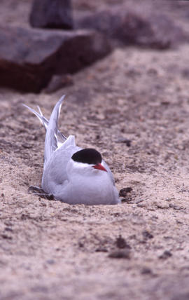
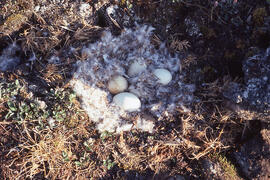
File contains 24 photographs taken by Bill Freedman at the Headland site, Leslie Street spit, Toronto, in 1977. Photographs show nesting terns (Caspian and Common) and gulls (Ring-billed and Herring).
File contains 86 photographs largely taken by Bill Freedman (although a few were taken by J.L. Riley and R. Vinebrooke), at several southern Ontario sites between 1972 and 2001. Photographs show plants along the Oakville River, in Algonquin and Point Pelee Parks, the Alvar marsh site (near Orillia), the Windsor prairie, and another site west of London.
File contains 12 photographs taken by Bill Freedman and Annette Lutterman in Quebec and Ontario between 1996 and 1999. Photographs show hydroelectric power scenes, including the dams and diversion channels of La Grande River dam, and Niagara Falls.