- MS-4-135, Box 136, Folder 3, Item 1
- Item
- 1924-1932
Part of Oland and Son fonds
Part of Oland and Son fonds
Part of Oland and Son fonds

Brew book: September 14, 1915 to November 16, 1917
Part of Oland and Son fonds
Brew book: April 1, 1944 to March 31, 1945
Part of Oland and Son fonds
Brew book: April 1, 1951 to March 31, 1952
Part of Oland and Son fonds
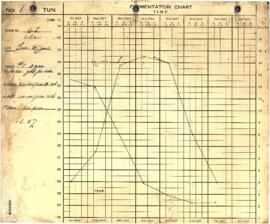
Brew book: April 1, 1952 to March 31, 1953
Part of Oland and Son fonds
Brew book: April 1, 1953 to March 31, 1954
Part of Oland and Son fonds
Brew book: October 1, 1913 to September 13, 1915
Part of Oland and Son fonds
Part of Oland and Son fonds
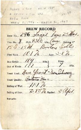
Brew book: April 1, 1945 to March 31, 1947
Part of Oland and Son fonds
Part of Oland and Son fonds
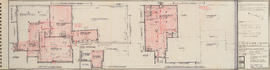
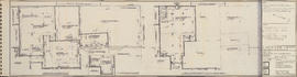
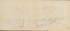
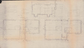
Cellar, first & second floor plans : Unit C
Part of Oland and Son fonds
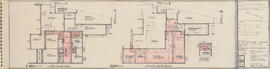
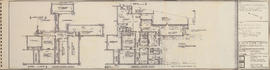
Cellar & ground floor plans : Unit B
Part of Oland and Son fonds
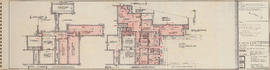
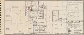
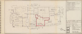
Ground & first floor plans : Unit A
Part of Oland and Son fonds
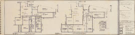
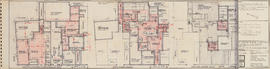
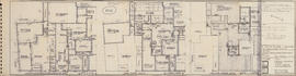
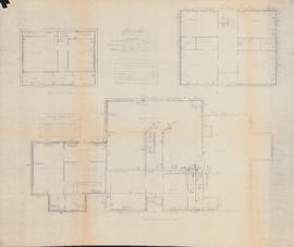
First & second floor plans : Unit B
Part of Oland and Son fonds

Part of Oland and Son fonds
Third & fourth floor plans : Unit C
Part of Oland and Son fonds
First & second floor plans : Unit B
Part of Oland and Son fonds
Part of Oland and Son fonds
Cellar, first & second floor plans : Unit C
Part of Oland and Son fonds
Cellar & ground floor plans : Unit B
Part of Oland and Son fonds
Ground & first floor plans : Unit A
Part of Oland and Son fonds
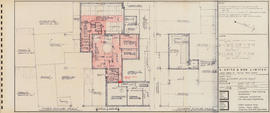
Third & fourth floor plans : Unit C
Part of Oland and Son fonds
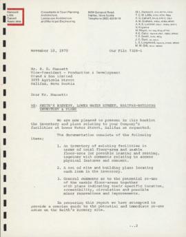
Booklet of inventory and plans for the Alexander Keith's Brewery building
Part of Oland and Son fonds
Brewing Book for Olands Brewery
Part of Oland and Son fonds
Oland and Son Limited
Part of Oland and Son fonds
![Bluenose II (built by Smith & Rhuland Lt.-Lunenburg) cross curves of stability : [graph]](/uploads/r/dalhousie-university-archives/9/b/9/9b9dac78aaffc1085adae3d9f8ccc9c605b0319c0df584cf4355e77efecff627/ms-4-135_os7_001_142.jpg)
Bluenose II (built by Smith & Rhuland Lt.-Lunenburg) cross curves of stability : [graph]
Part of Oland and Son fonds
![Bluenose II (built by Smith & Rhuland Ltd.-Lunbrg) hydrostatic curves : [graph]](/uploads/r/dalhousie-university-archives/d/e/a/dea903f5aab5486110af898a593c051b085c37a023a33fd547c0082a53f4ec73/ms-4-135_os7_002_142.jpg)
Bluenose II (built by Smith & Rhuland Ltd.-Lunbrg) hydrostatic curves : [graph]
Part of Oland and Son fonds
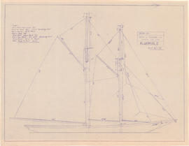
Drawing of the Bluenose II in full sail
Part of Oland and Son fonds
Drawing of the Maritime Supplies and Exchange warehouse and the electrical supply for Bluenose II
Part of Oland and Son fonds
Bluenose II proposed modification to propulsion shafting
Part of Oland and Son fonds

Proposed schematic diagram of electrical distribution 230 V.-115 V. A.C. & 115 V. D.C.
Part of Oland and Son fonds
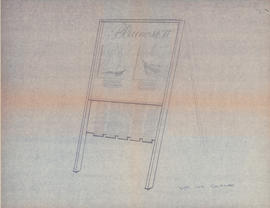
Sketch of a sandwich board sign for the Bluenose II
Part of Oland and Son fonds
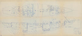
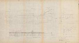
Drawing of the interior of the Bluenose II
Part of Oland and Son fonds
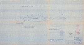
![General arrangement : [drawing of the Bluenose II interior]](/uploads/r/dalhousie-university-archives/4/0/8/40833b3c557883b5c7860be703a0362ecb1780f87cc08818f219097e72c23900/ms-4-135_os8_006_1_142.jpg)
General arrangement : [drawing of the Bluenose II interior]
Part of Oland and Son fonds
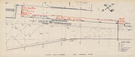
Map of the Saint Lawrence River with notes
Part of Oland and Son fonds
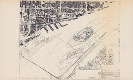
Map of the Saint Lawrence River in Montreal
Part of Oland and Son fonds
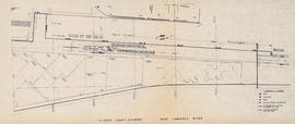
Map of the Saint Lawrence River
Part of Oland and Son fonds
Heating plans for three floors of the Sheet Anchor
Part of Oland and Son fonds
Part of Oland and Son fonds
Heating plans for three floors of the Sword and Anchor Inn
Part of Oland and Son fonds
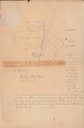
Land petition for property in Chester, Nova Scotia
Part of Oland and Son fonds
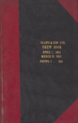
Brew book: April 1, 1952 to March 31, 1953
Part of Oland and Son fonds

Part of Oland and Son fonds
Part of Oland and Son fonds

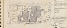
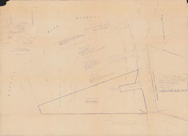
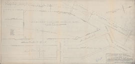
Plan showing properties bounded by Bishop, Hollis, Salter & Water Streets
Part of Oland and Son fonds
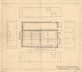
Plan & elevations of room in basement of plant for Keith & Son
Part of Oland and Son fonds

Plan & elevations of room in basement of plant for Keith & Son
Part of Oland and Son fonds

Floor plan of the kitchen at the Sword and Anchor Inn
Part of Oland and Son fonds
Map of lands to be conveyed to Oland and Son Limited by Dominion Steel and Coal Corporation Limited
Part of Oland and Son fonds