Collection contains twelve historical maps of Eastern Canada, produced by cartographers such as Giovanni Battista Ramusio and Girolamo Ruscelli. Donation also includes a copy of Kershaw's "Early Printed Maps of Canada" and a "A Monograph of the Evolution of the Boundaries of the Province of New Brunswick" by William F. Ganong.
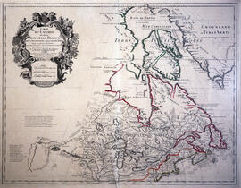
Item is a 1677 state of a map of Canada created in 1616 by Samuel de Champlain and augmented by Pierre Duval in 1653. Champlain never finished the plate for the map. was augmented and then published by Duval. The complete title of the map is Le Canada / faict par le Sr de Champlain / ou sont / la Nouvelle France / la Nouvelle Angleterre / la Nouvelle Holande / la Nouvelle Svede / la Virginie & c.
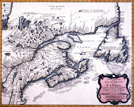
Item is a map of Nova Scotia and adjacent regions by Johannes De Laet. It is the first printed map to include an accurate depiction of Prince Edward Island, and the earliest depiction of a north-south orientated Lake Champlain.
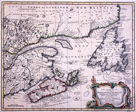
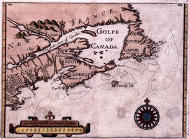
Item is a map of eastern North America created in 1625 by Sir William Alexander. The map depicts New France, New England, New Scotland, and Newfoundland.
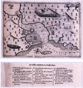
Item is a chart of a harbour showing a point of land with a cross. The chart was published on page thirty of Les voyages du sieur de Champlain Xaintongeois, capitaine ordinaire pour le roy en la marine (Paris: Jean Berjon, 1613). In this volume, Champlain describes the country around Port des mines or present-day Basin of Mines or Minas Basin, Nova Scotia, Canada. The river at the head of the bay is Shubenacadie River, but the location of the cross, which proves, according to the author, that Christians once lived there, is unknown. Champlain drew the original from which the engraving was made. Cartographic elements include soundings, shoals, compass rose, and ship. Chart also includes a waterfall or rapids, a dwelling, a group of First Nations people, and some topographical details. Items in image are lettered for identification in key below.
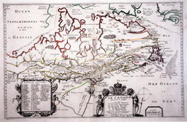
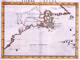
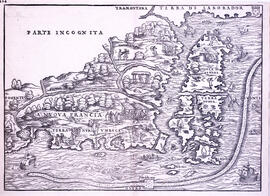
Item is a first edition map by Giovanni Battista Ramusio. Map contains La Nuova Francia, Terra de Laborador, and Terra Nuova. The map has proclaimed scale. The long curved line around the bottom and right side of the map represents the Grand Banks.