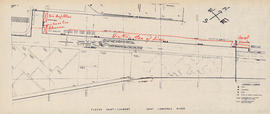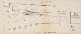
Map of the Saint Lawrence River
- MS-4-135, Oversized Folder 3, Item 5
- Item
- [196-?]
Part of Oland and Son fonds
Item is a photocopy of a map of an area on the St. Lawrence River. The map is identical to MS-4-135, Oversized Folder 3, Item 2, but without the handwritten notes.