Showing 19 results
Archival Description8 results with digital objects Show results with digital objects
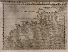
Tierra Nueva
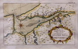
Plan du Port Royal dans l'Acadie, Appelle' Aujour d'par les Anglois Annapolis Royal by J.N. Bellin; Vol. 1, No.27
Plan du Chibouctou à la Côte d'Acadie avec les Côtes voisines, commissioned by Antoine de Sartine
Plan du Chibouctou à la Côte d'Acadie avec les Côtes voisines, commissioned by Antoine de Sartine
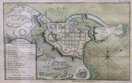
Plan de la Ville de Louisbourg dans l'Isle Royale by J.N. Bellin ; Vol. 1, No. 22
Nova Scotia : Map shows the Maritime Provinces, northern Maine, Anticosti, Gaspe and St. Lawrence River
Nova Scotia : Map shows the Maritime Provinces, northern Maine, Anticosti, Gaspe and St. Lawrence River
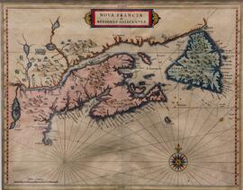
Nova Francia et Regiones Adjacentes
Map of the City of Halifax Co., Nova Scotia
Map of the City of Halifax Co., Nova Scotia
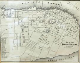
Map of the City of Halifax
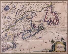
Map of the British and French plantations in North America
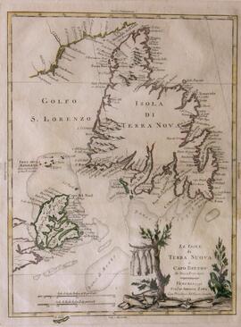
Le Isole di Terra Nuova e Capo Breton, Di Nuovo Projezione, by Antonio Zatta
Island of Cape Breton : Map shows all of Cape Breton, including Canso Isles, Chedabucto Harbour, Bra d'Or Lake, St. Anne, Cape North
Island of Cape Breton : Map shows all of Cape Breton, including Canso Isles, Chedabucto Harbour, Bra d'Or Lake, St. Anne, Cape North
Extrema Americae versus Boreaum, ubi Terra Nova, Nova Francia, Adjacentiaq, by Johannes Blaeu
Extrema Americae versus Boreaum, ubi Terra Nova, Nova Francia, Adjacentiaq, by Johannes Blaeu
Die Landtschafft Canada oder dass neue Franckreich [Canada or New France]
Die Landtschafft Canada oder dass neue Franckreich [Canada or New France]
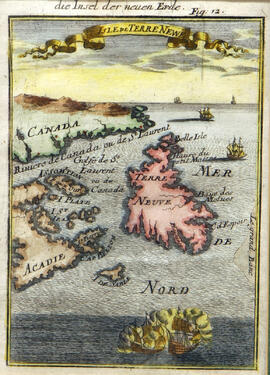
Die Insel der Neuen Erde Isle de Terr Newf.
Die Insel der Neuen Erde Isle de Terr Newf.
David and Marilyn Janigan Map Collection
David and Marilyn Janigan Map Collection
Chart of Chebucto Harbour, on the Coast of Accadia, or Nova Scotia, With the Plan of the Town of Halifax, by John Rocque
Chart of Chebucto Harbour, on the Coast of Accadia, or Nova Scotia, With the Plan of the Town of Halifax, by John Rocque
Carte Reduite Du Golphe De St. Laurent, Contenant l'Isle de Terre-Neuve et Partie de la Coste des Esquimaux, l'Isle Royale, l'Isle St. Jean et Celle d'Anticosti et ca.
Canada or New France ; Shows east coast of Canada and the United States and, extending west to and beyond the Great Lakes
Canada or New France ; Shows east coast of Canada and the United States and, extending west to and beyond the Great Lakes
A description of the Bay of Fundy, Showing the Coast, Islands, Harbours, Creeks, Coves, Rocks, Sholes, Soundings, &d Anchorings [Observed by Nathaniel Blackmore] From Moll's Atlas Minor
A description of the Bay of Fundy, Showing the Coast, Islands, Harbours, Creeks, Coves, Rocks, Sholes, Soundings, &d Anchorings [Observed by Nathaniel Blackmore] From Moll's Atlas Minor