- MS-4-135, OS Folder 1
- File
- May 1963
Part of Oland and Son fonds
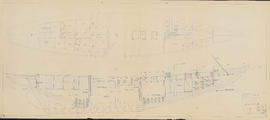
Item is a drawing of the Bluenose II prepared by Smith & Rhuland Ltd. of Lunenburg, Nova Scotia. The drawing shows a view from above and a cross section of the ship.
Part of Oland and Son fonds
Part of Oland and Son fonds
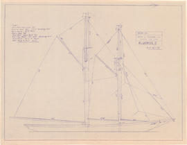
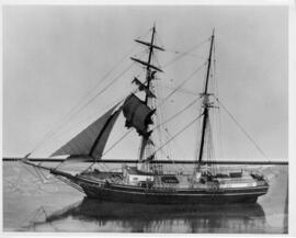
Drawing of the Bluenose II in full sail
Part of Oland and Son fonds
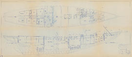
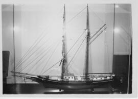
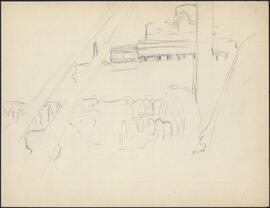
Drawing of the interior of the Bluenose II
Part of Oland and Son fonds
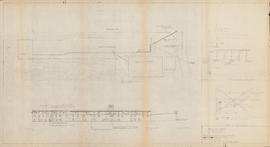
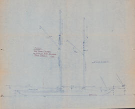
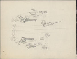
Drawing of the Maritime Supplies and Exchange warehouse and the electrical supply for Bluenose II
Part of Oland and Son fonds
Existing electrical arrangement of Bluenose IInd 32 volt D.C. & 115 volt A.C.
Part of Oland and Son fonds
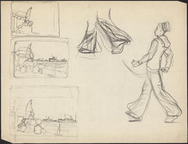
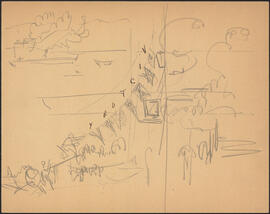
Five charcoal and pencil study sketches by Donald Cameron Mackay
Part of D.C. Mackay fonds
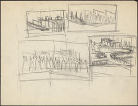
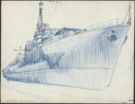
Four charcoal study sketches by Donald Cameron Mackay of naval ships in port
Part of D.C. Mackay fonds
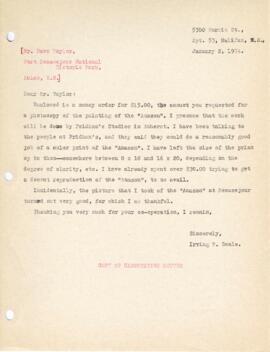
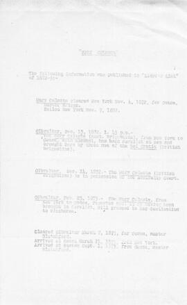
Further research correspondence regarding Mary Celeste
Part of Irving Deale collection
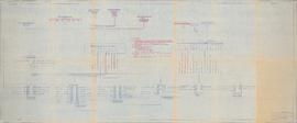
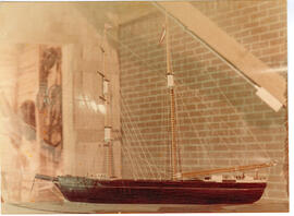
![General arrangement : [drawing of the Bluenose II interior]](/uploads/r/dalhousie-university-archives/4/0/8/40833b3c557883b5c7860be703a0362ecb1780f87cc08818f219097e72c23900/ms-4-135_os8_006_1_142.jpg)
General arrangement : [drawing of the Bluenose II interior]
Part of Oland and Son fonds
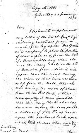
Gibraltar letter from Solly Flood
Part of Irving Deale collection
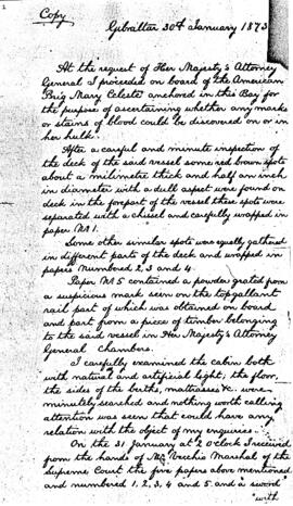
Gibraltar report from Dr. J. Patron
Part of Irving Deale collection
Part of Irving Deale collection
Item is a cartographic journal containing daily entries and twenty-five cartographic diagrams and topographical illustrations showing coastlines, elevations, distances (in leagues), water depths, capes, bays, rivers, inlets, islands and other geographical features.
From the accounts of the first few days, the jump off point must have been somewhere near Mahone Bay or Lunenburg, on the southern coast of Nova Scotia. Few observations are recorded during the first week; the aim seems to have been to reach an initial destination of Grand Manan Island. At this point, beginning on July 25, 1684, detailed observations are made of all islands, rocks, and other geographical objects, along with more specific information concerning water depths (given in braces), types of currents, prevailing winds, distances between landmarks (given in leagues), places of secure anchorage, danger zones, etc. Most of the observed areas are accompanied by topographical illustrations which depict not only the contours of the coastline, but also elevations from sea level.
The expedition proceeded from Grand Manan Island down into Passamaquoddy Bay (this is not named, but the St. Croix River is), then Northeast along the coast of New Brunswick to the entrance to the St. John River. At this point, the expedition encountered at least two British war vessels, equipped with cannons. An envoy from the expedition was sent to the British ships, apparently commanded by John Nelson, the nephew of the first proprietor of New Brunswick; assurances are exchanged, the envoy is returned, and the expedition again proceeds along its way. Much of this portion of the expedition was obscured by a dense and persistent thick fog which made the task of the cartographer at times impossible, as he frequently notes.
From St. John River, the expedition turned back again across the Bay of Fundy, along Long Island, down along the Western coast of Nova Scotia to Cape Sable. This destination is reached by July 31, 1684, and here some days are passed waiting out a violent storm. Another British ship is mentioned, though no contact was made. The coastline from Cape Sable all the way to Margaret's Bay is represented by numerous illustrations. The weather seems to have been more favourable, and much of the area was apparently uncharted.
This portion of the journey includes descriptions and illustrations of Cape Negro, Baye du Port Razor, Riv. des Jardins, Port Rosignol, Sable River, La Have Harbour, Mahone Bay (called here Mirligaich), Margaret's Bay, etc. The expedition continues from Margaret's Bay on to the Northeast, with observations of Cape Sambro, Riv. Chibouetou. Riv. Maganchis, Cape Thiodor, and it ends at St. Mary's River, on September 14, 1684.
Appended to the journal is a twelve page "Inventaire pour servir a l'armament et consommation du nav(igation)," in which a very detailed list of hundreds of items is presented. The two categories that receive the most attention are boat fixtures (e.g., sails, bowsprites, halyards, stays, topsails, masts, anchors, rope, riggings, etc.) and armaments (e.g., cannons, ammunitions, guns, other weapons, etc.). Surgical equipment is briefly mentioned. Extraneous observations are also included from time to time: an abundance of fish off Cape Forcheau; arborage and foliage on shore; disembarkments, during one of which one of the crew apparently attempted to desert.
Marianne (Ship)
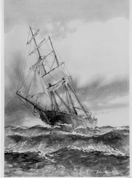
Mary Celeste artwork by John Worsley
Part of Irving Deale collection
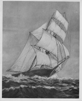
Mary Celeste artwork by Leslie Victor Smith
Part of Irving Deale collection
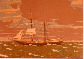
Mary Celeste artwork by Rudolph Ruzicka
Part of Irving Deale collection
Mary Celeste model at Atlantic Companies
Part of Irving Deale collection
Mary Celeste model at Mariners Museum
Part of Irving Deale collection
Mary Celeste model at Mystic Museum
Part of Irving Deale collection
Part of Irving Deale collection
Part of D.C. Mackay fonds
Part of D.C. Mackay fonds
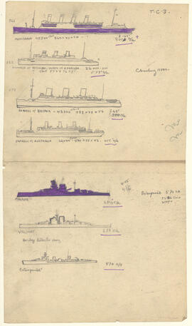
Pencil and ink silhouettes by Donald Cameron Mackay of seven allied ships
Part of D.C. Mackay fonds
Part of D.C. Mackay fonds
Pencil sketch by Donald Cameron Mackay of aft ship anatomy on an unidentified Canadian naval vessel
Part of D.C. Mackay fonds
Pencil sketch by Donald Cameron Mackay of ship silhouettes
Part of D.C. Mackay fonds
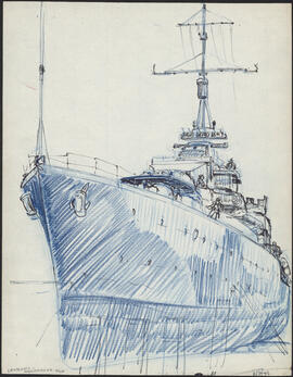
Pencil study sketch by Donald Cameron Mackay of a large naval ship in port
Part of D.C. Mackay fonds

Photograph of a boat called the Joan Ryan sitting on the shore in Fort Chimo, Quebec
Part of Barbara Hinds fonds
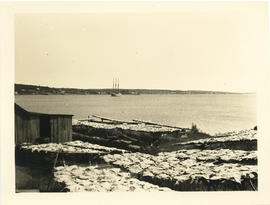
Photograph of a boat on the LaHave River
Part of Thomas Head Raddall fonds

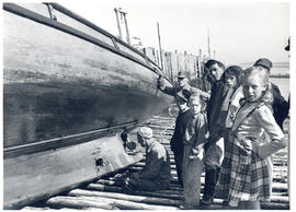
Photograph of a crowd of people on a dock watching a ship in Nain, Newfoundland and Labrador
Part of Barbara Hinds fonds
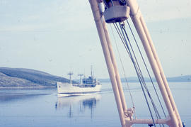
Photograph of a large ship in the narrows in Goose Bay, Newfoundland and Labrador
Part of Barbara Hinds fonds

Photograph of a large ship in the narrows of Goose Bay, Newfoundland and Labrador
Part of Barbara Hinds fonds
Part of Thomas Head Raddall fonds
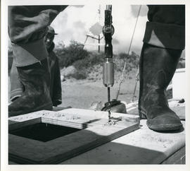
Photograph of a man using a drill while refitting the "Joan Ryan"
Part of Barbara Hinds fonds
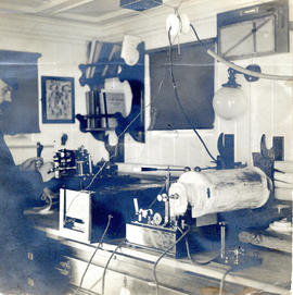
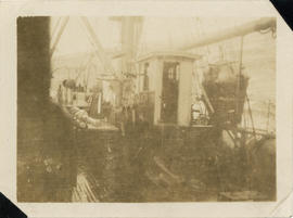
Photograph of a Marconi wireless telegraph in the chartroom of the cable-ship Mackay-Bennett
Part of Thomas Head Raddall fonds
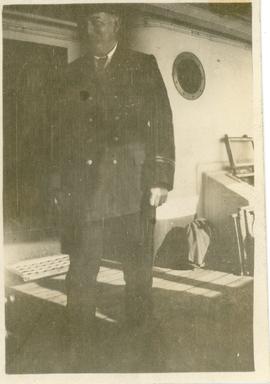
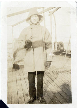
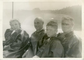
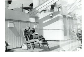
Photograph of a uniformed man on a sunny boatdeck
Part of Thomas Head Raddall fonds
Photograph of a wave about to break over the forward deck of the cable-ship Mackay-Bennett
Part of Thomas Head Raddall fonds
Photograph of an American ship in Goose bay, Newfoundland and Labrador
Part of Barbara Hinds fonds
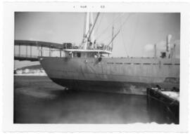
Photograph of an unidentified Pulp Ship at the East River Dock, Sheet Harbour
Part of Scott Paper Company fonds

Photograph of an unidentified Pulp Ship loading lumber at the East River Dock, Sheet Harbour
Part of Scott Paper Company fonds
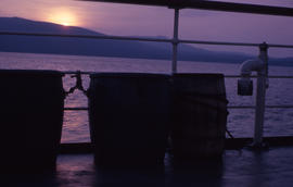
Photograph of barrels of salt beef and salt pork on board of a ship in Newfoundland and Labrador
Part of Barbara Hinds fonds
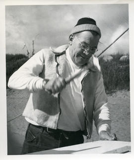
Photograph of Bill Walker hammering a nail
Part of Barbara Hinds fonds

Photograph of Bill Walker hammering a nail in Fort Chimo, Quebec
Part of Barbara Hinds fonds
Part of Thomas Head Raddall fonds
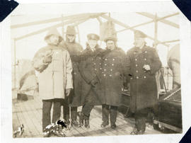
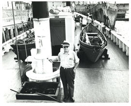
Photograph of crew members on the deck of the cable-ship Mackay-Bennett
Part of Thomas Head Raddall fonds
Part of Thomas Head Raddall fonds
Part of Thomas Head Raddall fonds
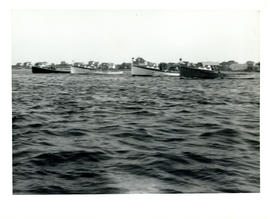
Photograph of four fishing boats aligned in the water near Cape Sable Island
Part of Thomas Head Raddall fonds
Part of Thomas Head Raddall fonds