Photographs of unidentified Olands soccer team players
- MS-4-135, Box 206, Folder 21
- Item
- [ca. 1960s]
Part of Oland and Son fonds
66 results with digital objects Show results with digital objects
Photographs of unidentified Olands soccer team players
Part of Oland and Son fonds
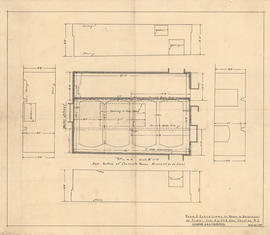
Plan & elevations of room in basement of plant for Keith & Son
Part of Oland and Son fonds

Plan & elevations of room in basement of plant for Keith & Son
Part of Oland and Son fonds
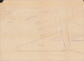
Plan of survey of lands of Richard H. Oland, Tremont Street, Chester, Lunenburg County, Nova Scotia
Part of Oland and Son fonds
Part of Oland and Son fonds
Part of Oland and Son fonds
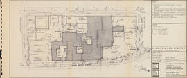
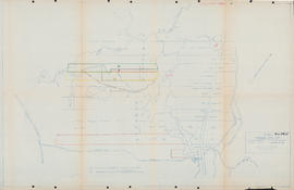
Plan showing lands owned by Oland's Brewers Grain & Yeast Limited and Sidney C. Oland
Part of Oland and Son fonds

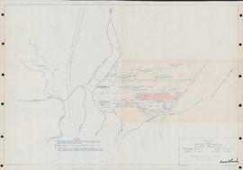
Plan showing properties bounded by Bishop, Hollis, Salter & Water Streets
Part of Oland and Son fonds
Post blast report for Keith Hall, 1475 Hollis Street
Part of Oland and Son fonds

Proposed schematic diagram of electrical distribution 230 V.-115 V. A.C. & 115 V. D.C.
Part of Oland and Son fonds
Register of brewers semi-monthly return
Part of Oland and Son fonds
Part of Oland and Son fonds

Site plan showing lands surveyed for Clayton Developments Ltd. : Middle Sackville
Part of Oland and Son fonds
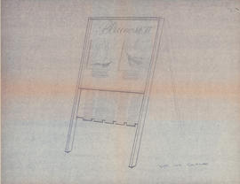
Sketch of a sandwich board sign for the Bluenose II
Part of Oland and Son fonds
Sketch of lots on Windsor Road in Upper Sackville, Nova Scotia
Part of Oland and Son fonds
Sketch showing various properties in Upper Sackville, Nova Scotia
Part of Oland and Son fonds
Part of Oland and Son fonds
The brewery revitalized, rough draft - presented by Clarridge House Advertising Limited
Part of Oland and Son fonds
The Halifax drink trade: 1870-1895 / Keith L. Johnston : manuscript
Part of Oland and Son fonds
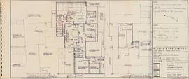
Third & fourth floor plans : Unit C
Part of Oland and Son fonds
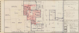
Third & fourth floor plans : Unit C
Part of Oland and Son fonds
Valuation of the vacant lot on Franklyn street, Halifax Nova Scotia / Speed & Speed Limited
Part of Oland and Son fonds