File contains 28 photographs taken by Bill Freedman near the Tufts Cove Generating Station, Dartmouth, Nova Scotia, in August 1989. Photographs show damage to vegetation (Red oak, pumpkin, cucumber, and tomato) potentially caused by the accidental emission of acidic particulates from the generating station.
File contains 73 photographs taken by Bill Freedman at the sites of small, controlled, experimental oil spills near Tuktoyaktuk (Pingo, Point, Meadow, Lupin), predominantly from 1973 and 1974. Also includes some photos from similar experiments at Cape Parry. Photographs document experimentation of regrowth of vegetation in response to small-scale oil spills.
File contains 116 photographs taken by Bill Freedman in the region around Sudbury, Ontario, between 1975 and 1986, as part of his thesis fieldwork. Photographs show slag heaps, roast beds, pollution, plant damage, and mining infrastructure from the Copper Cliff, Coniston, and Falconbridge sites near Sudbury, and flora at the nearby Wanapitei River, Richard Lake, and Burwash sites.
File contains 36 photographs taken by Bill Freedman in the area around Sudbury, Ontario, between 1975 and 1986 (many of which were used as part of his thesis fieldwork). Photographs show tailings ponds, nickel runs, roast beds, and slag pouring at the Coppercliff, Burwash, Coniston, Richard Lake, and Falconbridge sites.
File contains 6 photographs taken by Roger Belanger (and collected by Bill Freedman), likely in 1970. Photographs show clean-up efforts after the oil spill after the SS Arrow ran aground during a gale, in Chedabucto Bay, February 4, 1970.
File contains 68 photographs taken largely by Bill Freedman (but also by Sweeney) at Point Pleasant Park, Halifax, Nova Scotia, in 2000. Photographs show aerial and up-close examples of the destruction wrought on the urban park by the invasive Brown spruce longhorn beetle, believed to arrive in the city via the nearby port.
File contains 77 photographs taken by Bill Freedman at Sable Island, Nova Scotia, over several visits between 1981 and 1982. Photographs show vegetation, brackish ponds, aerial surveys, wild horses, as well as some of the researchers. File also includes 3 transparencies.
File contains 51 photographs taken by Bill Freedman in the Postville area of Labrador, between 1975 and 1977 (predominantly 1977). Photographs show geological formations, bogs, and flora around the Michelin Lake area near Postville. File also contains some photographs of flora taken at Terra Nova National Park
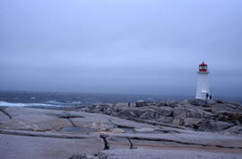
File contains 22 photographs taken by Bill Freedman between 1989 and 2001. Photographs show vegetation at the Murchyville bog (near Moose River, Nova Scotia), a Christmas tree lot in Lunenburg County, the barrens at Polly Cove (Halifax County), and examples of the endangered Geum peckii on Brier Island (Digby County).
File contains 58 photographs taken by Bill Freedman at Voisey's Bay, Labrador, in 1996. Photographs show river rapids, aerial surveys of the region, Fraser River Canyon, and some ground vegetation, near the site of the nickel mining operation. Late in 1996, Inco acquired rights to mine nickel from the area, and Freedman's visit involved conducting an environmental assessment (which he had done previously for nickel mining sites in Sudbury, Ontario).