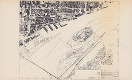
Map of the Saint Lawrence River in Montreal
- MS-4-135, Oversized Folder 3, Item 3
- Item
- [ca. 1967]
Part of Oland and Son fonds
Item is a photocopy of a map of Montreal and the Saint Lawrence River and Montreal, including Ile Sainte-Helene, Ile Notre Dame, and a ship berthing area. The original map was produced by the Canadian Corporation for the 1967 World Exhibition.