Add to clipboard
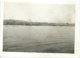
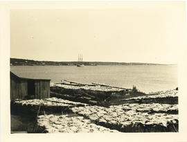
Photograph of the waterfront of a city taken from the water
Add to clipboard
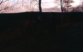
Photograph of three unidentified men near old farms (alte hofe)
Add to clipboard
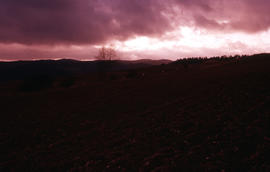
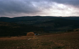
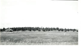
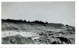
Photograph of landscape near old farms (alte hofe)
Add to clipboard
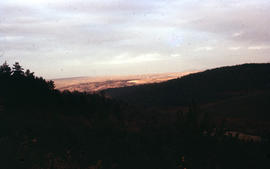
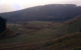
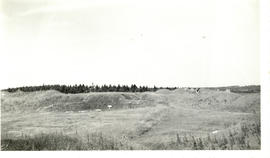
Photograph of hillside landscape near old farms (alte hofe)
Add to clipboard
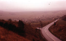
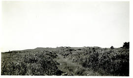
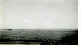
Photograph of a street and landscape between Bitburg and Daun
Add to clipboard
Photograph of landscape between Bitburg and Daun
Add to clipboard
Photograph of landscape near old farms (alte hofe)
Add to clipboard
Photograph of three unidentified men taking photographs near old farms (alte hofe)
Add to clipboard
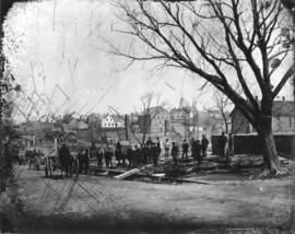
Photograph of New Glasgow after the fire of April 19, 1874
Add to clipboard
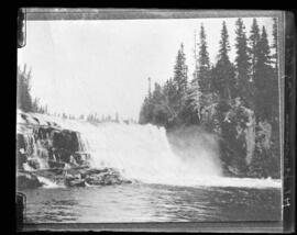
Photograph of a waterfall commissioned by Mr. H. J. Jennison
Add to clipboard
Photograph of a boat on the LaHave River
Add to clipboard
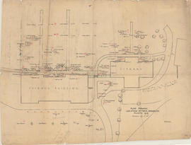
Plan showing location of trees, shrubs, etc. planted 1919
Add to clipboard
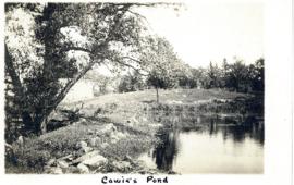
Photograph of Cowie Pond printed on a postcard
Add to clipboard
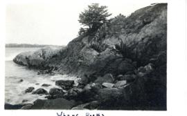
Photograph of the Wharf Rocks at Liverpool, Nova Scotia printed on a postcard
Add to clipboard
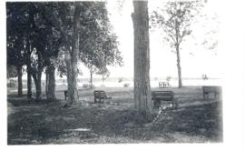
Photograph of Fort Point Park, Liverpool, Nova Scotia printed on a postcard
Add to clipboard
Photograph of Ecclesbourne Cliff, Hastings, East Sussex, England printed on a postcard
Add to clipboard
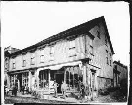
Photograph of a street scene in New Glasgow
Add to clipboard
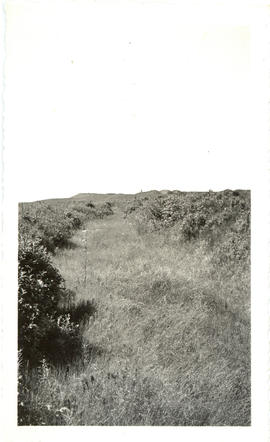
Photograph of Fort Beausejour from an old trench leading to the outworks
Add to clipboard
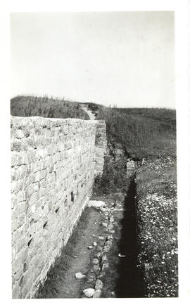
Photograph of the interior of a stone curtain at Fort Beausejour
Add to clipboard
Photograph of Fort Beausejour observed from a pavilion
Add to clipboard
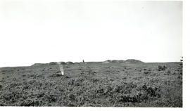
Photograph of Fort Beausejour taken from one of the flanking trenches
Add to clipboard
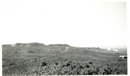
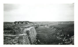
Photograph of the ridge at Fort Beausejour
Add to clipboard
Photograph of a pavilion at Fort Beausejour
Add to clipboard
Photograph from Fort Beausejour facing east-southeast taken from the southeast bastion
Add to clipboard
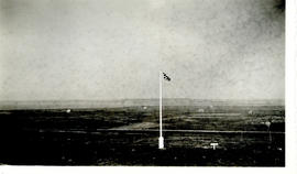
Photograph of a flag at Fort Beausejour looking southwest towards Westcock
Add to clipboard
Photograph of the interior of Fort Beausejour
Add to clipboard
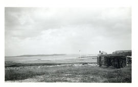
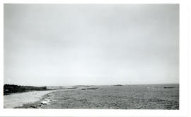
Photograph of Lighthouse Point from across the Louisbourg harbour
Add to clipboard
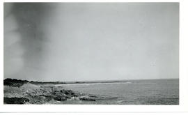
Photograph of Flat Point, Louisbourg taken from the shore facing Kennington Cove
Add to clipboard
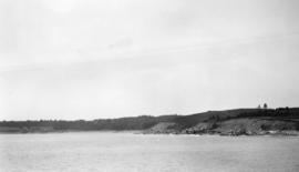
Photograph looking west from Kennington Cove, Louisbourg
Add to clipboard
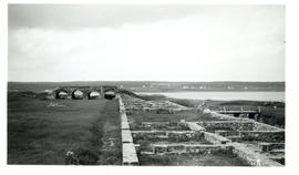
Photograph of the inner moat between the town and King's bastion at the Fortress of Lousibourg
Add to clipboard
Photograph looking east from Flat Point Cove, Louisbourg
Add to clipboard
Photograph of Flat Point, Louisbourg
Add to clipboard
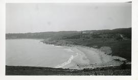
Photograph of Kennington Cove, Louisbourg
Add to clipboard
Photograph looking west from Kennington Cove's nid-de-pie position
Add to clipboard
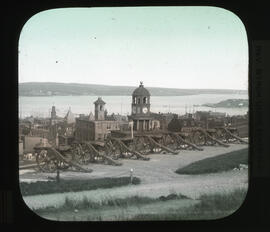
Photograph of the King's Bastion at the Fortress of Louisbourg
Add to clipboard
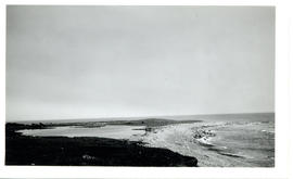
Photograph of the beach at Kennington Cove, Louisbourg
Photograph of the view over Truro from campus taken from upper level of school building showing homes and farmland in 1946
Add to clipboard
Photograph of the view over Truro from campus taken from upper level of school building showing homes and farmland in 1946
Photograph of the view over Truro from campus featuring homes and farmland in 1946
Add to clipboard
Photograph of the view over Truro from campus featuring homes and farmland in 1946
Photograph of ditching machine and two men installing drainage tiles
Add to clipboard
Photograph of ditching machine and two men installing drainage tiles
Photograph of the Nova Scotia Agricultural College campus facing south-east, in view are Cumming Hall, the horticulture building, greenhouses, and original barns (where quad/library and Cox building are now)
Add to clipboard
Photograph of the Nova Scotia Agricultural College campus facing south-east, in view are Cumming Hall, the horticulture building, greenhouses, and original barns (where quad/library and Cox building are now)
Add to clipboard
Photograph of Halifax, Nova Scotia seen from Citadel Hill
Photograph of the Nova Scotia Agricultural College campus, partial view of barn, streets, and homes on southern side of campus
Add to clipboard
Photograph of the Nova Scotia Agricultural College campus, partial view of barn, streets, and homes on southern side of campus
Add to clipboard
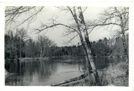
Photograph of the Shelburne River looking downstream from the "Low Bridge"
Add to clipboard
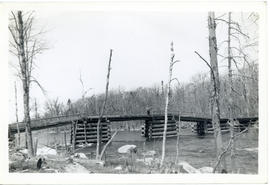
Photograph of J.A. Parker standing at the edge of the bridge over Pollards Falls, on the Shelburne River
Add to clipboard
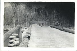
Photograph of J.A. Parker and Celine and Maurice Russell fishing off the bridge over Pollards Falls, on the Shelburne River in Queens County
Add to clipboard
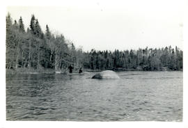
Photograph of J.A. Parker and Dunlap fishing from a canoe downstream from the "Low Bridge" to Pollards Falls on the Shelburne River
Add to clipboard
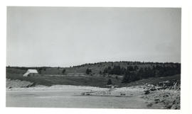
Photograph of the exposed bottom of Lake Wentworth, New Hampshire after a long drought
Add to clipboard
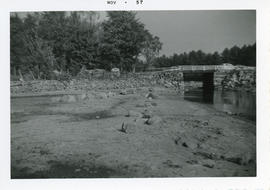
Photograph of the low water level under a bridge at Smith's River, an outlet of Lake Wentworth, New Hampshire after a severe summer drought
Add to clipboard
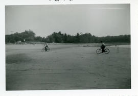
Photograph of two boys riding their bicycles on the exposed bottom of Lake Wentworth after an extreme drought
Add to clipboard
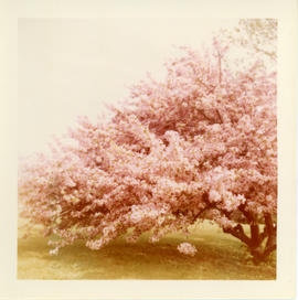
Photograph of the flowering Chinese crab apple tree on the grounds of the Governor Wentworth House in Little Harbor, New Hampshire