Showing 66 results
Archival Description
Carleton Stanley's submission to the Halifax Herald about a new Carnegie Corporation endowment
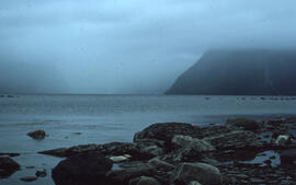
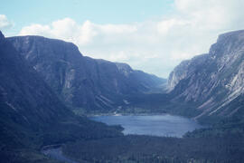
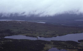
Photograph of a fjord and low-lying cloudcover at Gros Morne National Park, Newfoundland and Labrador
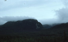
Photograph of fjord headlands at Gros Morne National Park, Newfoundland and Labrador
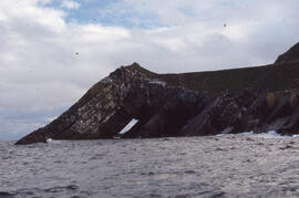
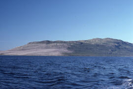
Photograph of Gull Island, near Cape St. Mary's, Newfoundland and Labrador
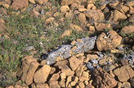
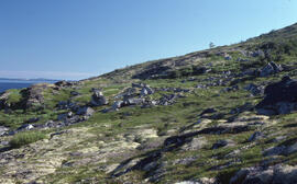
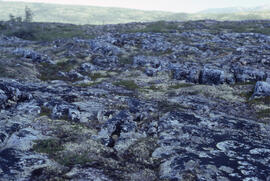
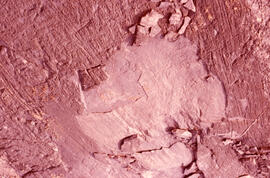
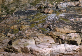
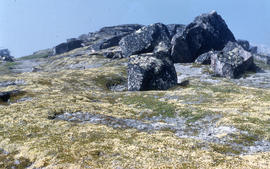
Photograph of serpentine rocks at Gros Morne National Park, Newfoundland and Labrador
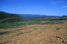
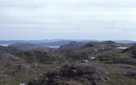
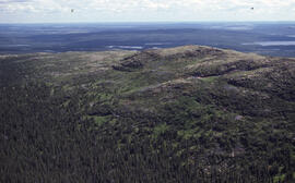
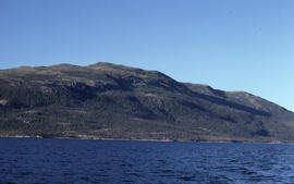
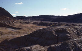
Photograph of the Gros Morne serpentine and vicinity, Newfondland and Labrador
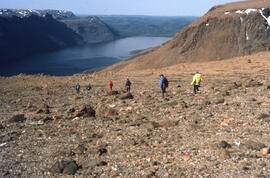
Photograph of six unidentified people walking across the barren serpentine uplands of Gros Morne National Park, Newfoundland and Labrador
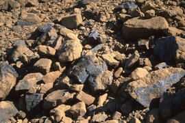
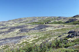
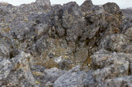
Photograph of serpentine rocks at Gros Morne National Park, Newfoundland and Labrador
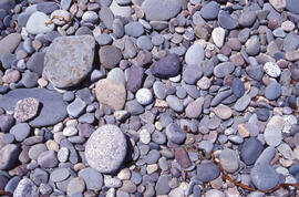
Photograph of round stones on the coast along the Gaff Point trail, near Kingsburg, Nova Scotia
Photograph of upland tundra area overlooking Voisey's Bay, Newfoundland and Labrador
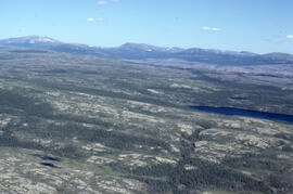
Aerial photograph of the Fraser River canyon, near Voisey's Bay, Newfoundland and Labrador
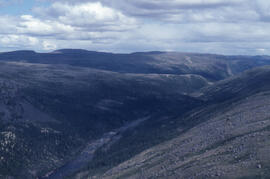
Photograph of the Fraser River canyon, near Voisey's Bay, Newfoundland and Labrador
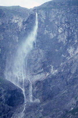
Photograph of a waterfall in the Fraser River Gorge, near Voisey's Bay, Newfoundland and Labrador
Aerial photograph of tundra at 2500 feet near Postville, Newfoundland and Labrador
Aerial photograph of altitudinal tundra at 2500 feet elevation, near Postville, Newfoundland and Labrador
Photograph of altitudinal coastal tundra near Postville, Newfoundland and Labrador
Photograph of Long Island, near Postville, Newfoundland and Labrador
Photograph depicting glacial striation near Postville, Newfoundland and Labrador
Photograph of altitudinal coastal tundra near Postville, Newfoundland and Labrador
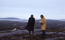
Photograph of two unidentified people standing on barren areas around 1500 feet elevation, near Postville, Newfoundland and Labrador
Photograph of Long Island from Kaipokok Bay near Postville, Newfoundland and Labrador
Photograph of barrens at 500-foot elevation near Michelin Lake, Newfoundland and Labrador
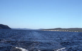
Photograph showing Postville, Newfoundland and Labrador from the middle of Kaipokok Bay
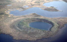
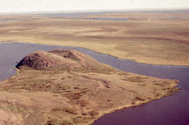
Aerial photograph of a collapsed pingo on the Tuktoyaktuk Peninsula, Northwest Territories
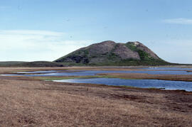
Photograph of Split Pingo, near Tuktoyaktuk, Northwest Territories
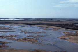
Photograph of a view from the top of Split Pingo, near Tuktoyaktuk, Northwest Territories
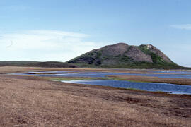
Photograph of Split Pingo near Tuktoyaktuk, Northwest Territories
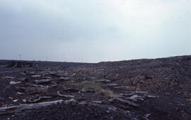
Photograph of slag heaps near a denuded slope junction, Coniston mining site, near Sudbury, Ontario
Photograph of exposed bedrock at the Coniston site, near Sudbury, Ontario
Photograph of slag heaps and exposed bedrock at the Coniston site, near Sudbury, Ontario
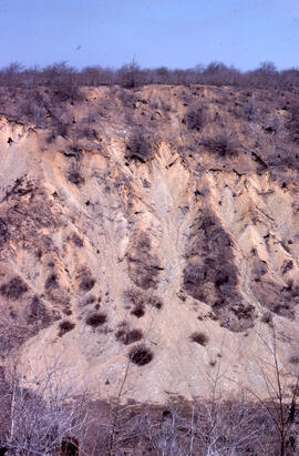
Photograph of cliff erosion at the Falconbridge site, near Sudbury, Ontario
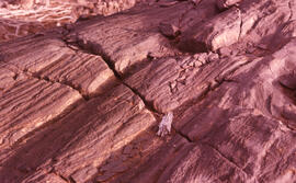
Photograph of glacial striae at Coniston site, near Sudbury, Ontario
Aerial photograph showing a collapsing pingo, Tuktoyaktuk Peninsula, Northwest Territories
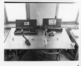
Photograph of equipment in the Geotechnical Soil Testing Lab at the Nova Scotia Technical College
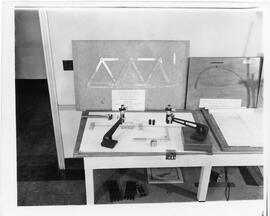
Photograph of equipment in the Geotechnical Soil Testing Lab at the Nova Scotia Technical College
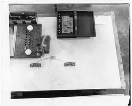
Photograph of equipment in the Geotechnical Soil Testing Lab at the Nova Scotia Technical College
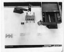
Photograph of equipment in the Geotechnical Soil Testing Lab at the Nova Scotia Technical College
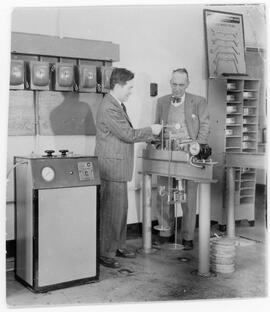
Photograph of G.G. Meyerhof and a client in the Geotechnical Soil Testing Lab at Nova Scotia Technical College
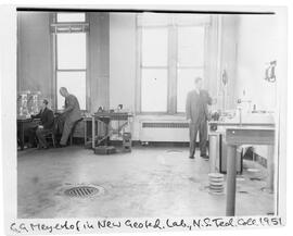
Photograph of G.G. Meyerhof in the Geotechnical Soil Testing Lab at the Nova Scotia Technical College
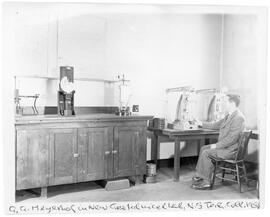
Photograph of G.G. Meyerhof in the Geotechnical Soil Testing Lab at the Nova Scotia Technical College
Early Experiments
Lecture 7 - Geology, Volcanic Theory
Lecture 6 - Theories of the Earth
Lightning and other Phenomena: Lectures on Electricity
Lecture of H. Davy
Clays of Antigonish
G.V. Douglas, book no. 1
Photograph of rock formation in Leach Bay, Northwest Territories
Photograph of vegetation and rock formations on the tundra in George River, Quebec
Photograph of a rock formation in the eastern Canadian Arctic
Results 1 to 50 of 66