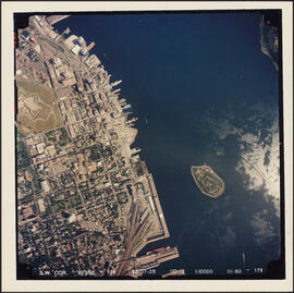
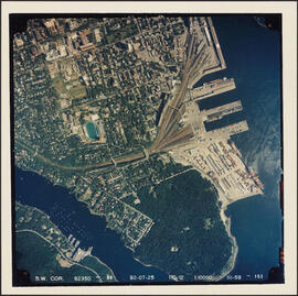
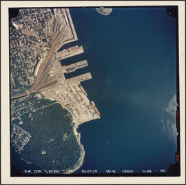
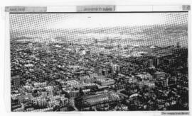
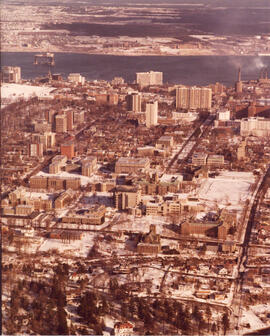
Item is an aerial photograph of the Halifax peninsula taken on July 25, 1992. The photograph shows downtown Halifax, the Halifax Container Piers, Halifax Harbour, and Georges Island.
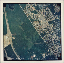
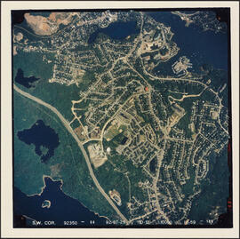
Item is an aerial photograph of the Clayton Park area of Halifax, on July 25, 1992. The photograph shows a largely undeveloped area of Clayton Park north of the Mainland Linear Trail, the 102 highway, and initial construction in the Bayers Lake Industrial Park area.
Item is an aerial photograph of the Clayton Park, Beechwood Park, and Fairview areas of Halifax, on July 25, 1992. The photograph also shows the Bedford Basin Container Pier and a small part of the West End of the Halifax peninsula.
Item is an aerial photograph of the Clayton Park and Fairview areas of Halifax, on July 25, 1992. The photograph also shows a largely undeveloped area of Clayton Park north of the Mainland Linear Trail.
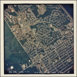
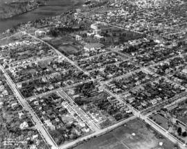
Item is an aerial photograph of the Clayton Park area of Halifax, on July 25, 1992. The photograph shows suburban developments in Clayton Park, as well as the largely undeveloped area north of the Mainland Linear Trail, the 102 highway, and initial construction in the Bayers Lake Industrial Park area.
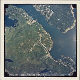
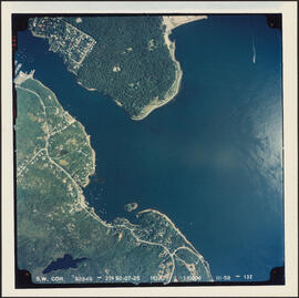
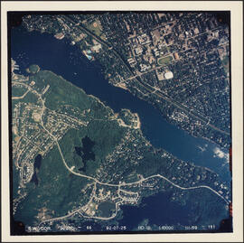
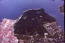
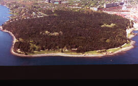
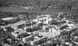
Item is an aerial photograph of the Northwest Arm and Point Pleasant Park, Halifax, on July 25, 1992. The photograph shows the coast of the Harbour approaches as far as Purcell's Cove.
Item is an aerial photograph of the Northwest Arm and Point Pleasant Park, Halifax, on July 25, 1992. The photograph shows the coast of the Harbour approaches south of Point Pleasant Park, as far as Ferguson's Cove.
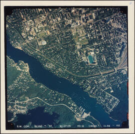
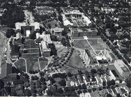
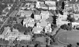
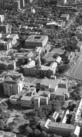
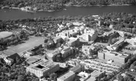
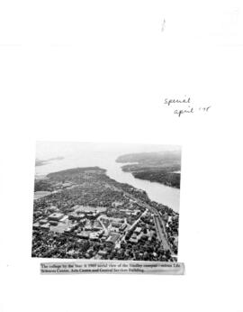
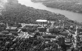
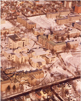
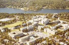
Item is an aerial photograph of the Northwest Arm in Halifax, Nova Scotia taken on July 25, 1992. The photograph shows the campuses of Dalhousie University and Saint Mary's University.
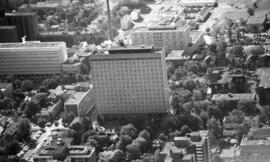
Item is an aerial photograph of Point Pleasant Park and the south end of Halifax, Nova Scotia taken on July 25, 1992. The photograph shows the campus of Saint Mary's University and the South End Container Terminal.
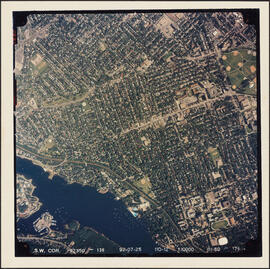
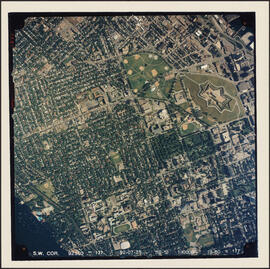
Item is an aerial photograph of the Halifax peninsula taken on July 25, 1992. The photograph shows downtown Halifax, the Halifax Common, the Halifax Citadel, and the Container Pier. The campus of Saint Mary's University is featured in the southern side of the photograph.
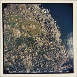
Item is an aerial photograph of the Halifax penninsula taken on July 25, 1992. The photograph shows West End and South End Halifax and part of the Halifax Common.
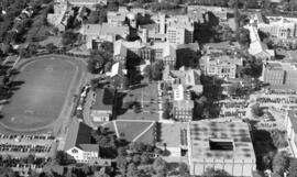
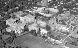
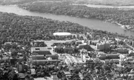
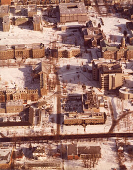
Item is an aerial photograph of the Halifax penninsula taken on July 25, 1992. The photograph shows South End Halifax, the Halifax Common, and the Halifax Citadel. The campus of Dalhousie University is featured in the southern side of the photograph.
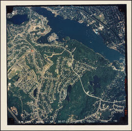
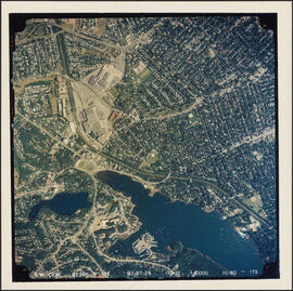
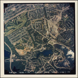
Item is an aerial photograph of communities surrounding the Armdale traffic circle taken on July 25, 1992. The photograph shows the Northwest Arm, parts of West End Halifax, and Armdale.
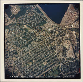
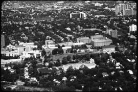
Item is an aerial photograph of communities surrounding the Armdale traffic circle taken on July 25, 1992. The photograph shows Fairmount, Fairview, and part of West End.
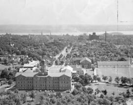
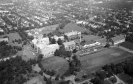
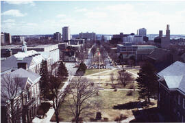
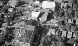
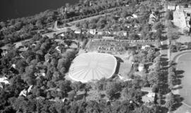
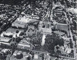
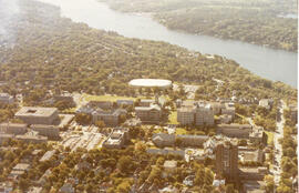
Item is an aerial photograph of Dalhousie University's Studley Campus. The photograph was taken by the Royal Canadian Air Force before the construction of of the Arts and Administration Building in 1951.