Showing 1015 results
Archival Description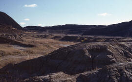
Photograph of slag heaps and exposed bedrock at the Coniston site, near Sudbury, Ontario
Photograph of Creeping bentgrass (Agrostis stolonifera) near slag heaps at the Coniston site, near Sudbury, Ontario
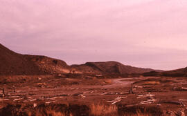
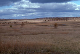
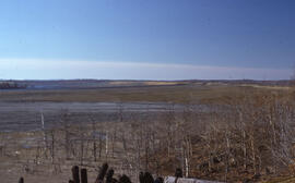
Photograph showing scenery between the Richard Lake and Coniston sites, near Sudbury, Ontario
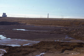
Photograph of a slag heap at the Coniston site, near Sudbury, Ontario
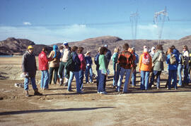
Photograph of a group of researchers standing at the Coniston site, near Sudbury, Ontario
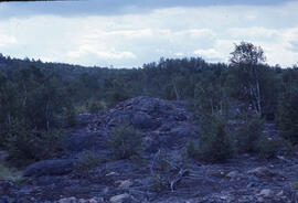
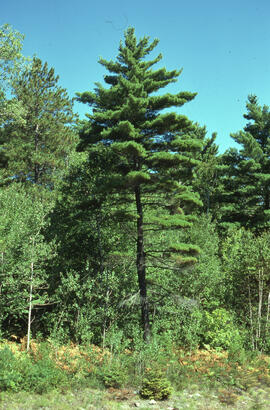
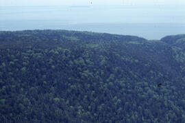
Photograph of a wooded hilltop near the Richard Lake site, near Sudbury, Ontario
Photograph of tufted hair grass (Deschampsia caespitosa) at Coniston site, near Sudbury, Ontario
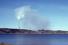
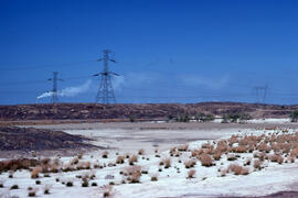
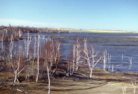
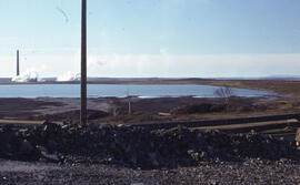
Photograph of Kelly Lake, 3 kilometres from the Inco Superstack, near Sudbury, Ontario
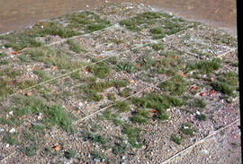
Photograph of tailings growing trials with a gravel base at the Nickel Rim site, Falconbridge, near Sudbury, Ontario
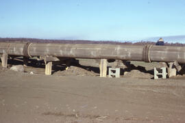
Photograph of wooden tailings pipes at the Copper Cliff site, near Sudbury, Ontario
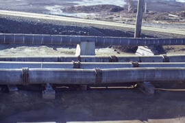
Photograph of an active tailings pond at the Copper Cliff site, near Sudbury, Ontario
Photograph of the revegetation of a former tailings area at the Copper Cliff site, near Sudbury, Ontario
Photograph of the revegetation of a former tailings area at the Copper Cliff site, near Sudbury, Ontario
Photograph of nodding thread-moss (Pohlia nutans) at the Copper Cliff site, near Sudbury, Ontario
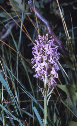
Photograph of purple fringed orchid (Habenaria fimbriata) at Wanapitei River, near Sudbury, Ontario
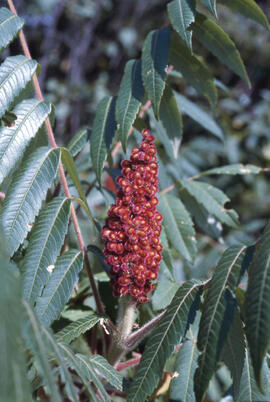
Photograph of Staghorn sumac (Rhus typhina) at Wanapitei River, near Sudbury, Ontario

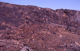
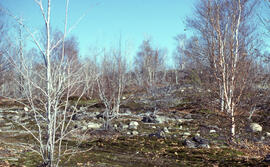
Photograph of a denuded hilltop 4 kilometres from the Copper Cliff site, near Sudbury, Ontario
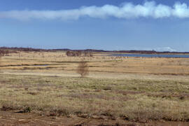
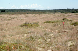
Photograph of a control site about 30 kilometres from mining operations near Sudbury, Ontario
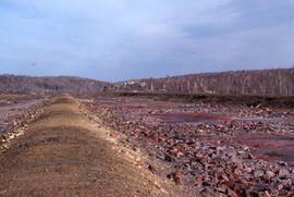
Photograph of a roast bed at the Falconbridge site, near Sudbury, Ontario
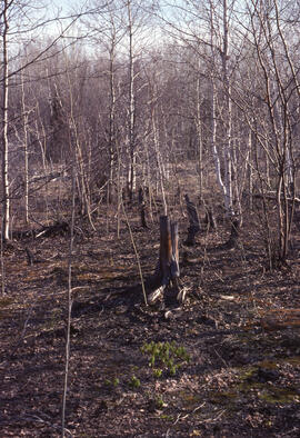
Photograph of vegetation regrowth at a 50-year-old roast bed site, near Sudbury, Ontario
Photograph of a stand of trees 6 kilometres from the Inco Superstack, Copper Cliff site, near Sudbury, Ontario
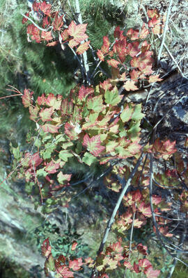
Photograph of sulfur dioxide damage to red maple (Acer rubrum) at the Copper Cliff site, near Sudbury, Ontario
Photograph of wooden corrosion-resistant tailing slurry pipes, Copper Cliff, near Sudbury, Ontario
Photograph of an active tailings pond at Copper Cliff, near Sudbury, Ontario
Photograph of an active tailings site at Copper Cliff, near Sudbury, Ontario
Photograph of an active tailings pond at Copper Cliff, near Sudbury, Ontario
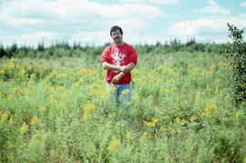
Photograph of Richard Morash standing in a glyphosate spray plot, six years after spraying, Little River Lake site, Kings County, Nova Scotia
Photograph of planted spruce growth in a reference plot, Riverside site, central Nova Scotia
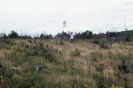
Photograph of an unidentified person observing regrowth one year after glyphosate spraying, Riverside site, central Nova Scotia
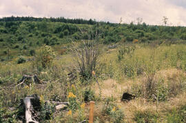
Photograph showing the contrast between sprayed and unsprayed sites, one year after first glyphosate spray, Antrim site, Halifax County, Nova Scotia
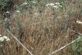
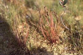
Photograph of oatgrass (Dantharia spicata) regrowth in a controlled area two years after glyphosate spraying, Antrim site, Halifax County, Nova Scotia

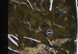
Photograph of a petri dish containing Rhodamine spray deposition at the Riverside site, central Nova Scotia
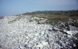
Photograph of persistent litter and discarded lobster traps on Bon Portage Island, Shelburne County, Nova Scotia
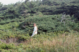
Photograph of an unidentified person standing in a range of Krummholz spruce on Bon Portage Island, Shelburne County, Nova Scotia
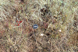
Photograph of the endangered Thread-leaved sundew (Drosera filiformis) at Baccaro bog, Shelburne County, Nova Scotia
Photograph of the endangered Thread-leaved sundew (Drosera filiformis) at Swaine's Road bog, Shelburne County, Nova Scotia
Photograph of Thread-leaved sundew (Drosera filiformis) growing amid bulrush (Trichophoetum) near Baccaro bog, Shelburne County, Nova Scotia
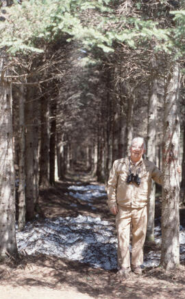
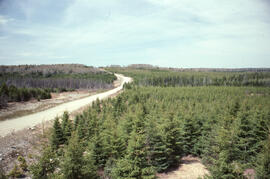
Photograph of Pat Marceau standing in a 30 year Irving Black Brook District spruce plantation, northwestern New Brunswick
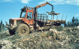
Photograph of a crane loading felled trees onto a truck in the Irving Black Brook District, northwestern New Brunswick
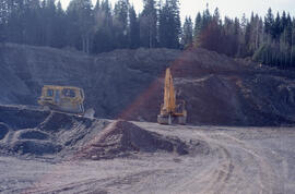
Photograph of gravel mining from an esker to pave forest roads in the Irving Black Brook District, northwestern New Brunswick
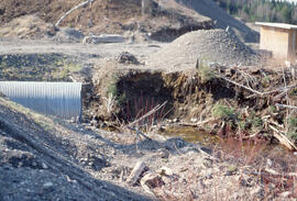
Photograph of a culvert alongside a forest road, Irving Black Brook District, northwestern New Brunswick
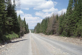
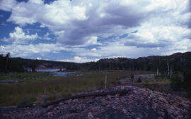
Photograph of natural, mature, spruce-fir forest in the Irving Black Brook District, northwestern New Brunswick
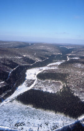
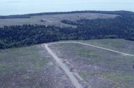
Aerial photograph of forestry cut overs in northern New Brunswick
Aerial photograph of a spruce plantation from an Irving lookout near Fundy National Park, New Brunswick
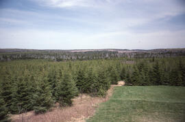
Photograph of a spruce plantation from an Irving lookout near Fundy National Park, New Brunswick
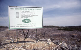
Photograph of an Irving sign at a nearly prepared clearcut site near Fundy National Park, New Brunswick
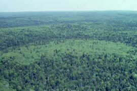
Aerial photograph of dense natural forest near Fundy National Park, New Brunswick
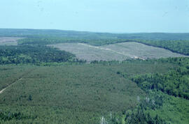
Aerial photograph of a regenerating spruce plantation near Fundy National Park, New Brunswick
Aerial photograph of a dense natural forest landscape in Fundy National Park, New Brusnwick
Aerial photograph of a regenerating plantation near Fundy National Park, New Brunswick
Results 51 to 100 of 1015