
Chart of the harbour of Halifax in Nova Scotia
- MS-2-756, OS Folder 8
- Item
- 1775
Part of The Pullen Map Collection
9 results directly related Exclude narrower terms
Chart of the harbour of Halifax in Nova Scotia
Part of The Pullen Map Collection
David and Marilyn Janigan Map Collection
Janigan, David
Exact chart of the River Saint Lawrence
Part of The Pullen Map Collection
Part of George Burden map collection
Bowen, Emmanuel, 1694-1767
Part of George Burden map collection
Randle, Charles, 1755-1813
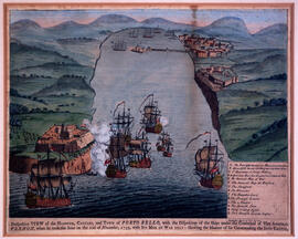
Perspective view of the harbour, coasts and town of Porto Bello
Part of The Pullen Map Collection

Plan du port de Chibouctou à la côte de l'Acadie avec les côtes voisines
Part of The Pullen Map Collection
Port de Louisebourg dans l'Isle Royale
Part of George Burden map collection
Bellin, Jacques Nicolas, 1703-1772