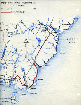
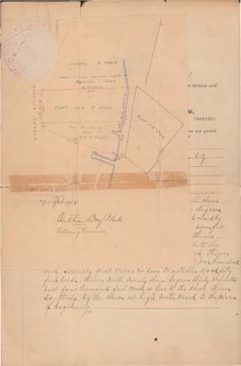
Map of Broad Cove Rural Telephone Company's telephone line
- MS-4-180, Box 172, Folder 30
- File
- January 6, 1932
Map of Broad Cove Rural Telephone Company's telephone line
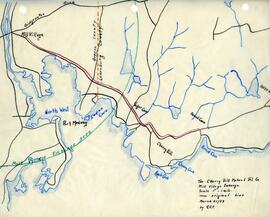
Map of Cherry Hill Mutual Telephone Company's telephone line
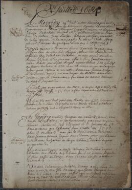
Item is a cartographic journal containing daily entries and twenty-five cartographic diagrams and topographical illustrations showing coastlines, elevations, distances (in leagues), water depths, capes, bays, rivers, inlets, islands and other geographical features.
From the accounts of the first few days, the jump off point must have been somewhere near Mahone Bay or Lunenburg, on the southern coast of Nova Scotia. Few observations are recorded during the first week; the aim seems to have been to reach an initial destination of Grand Manan Island. At this point, beginning on July 25, 1684, detailed observations are made of all islands, rocks, and other geographical objects, along with more specific information concerning water depths (given in braces), types of currents, prevailing winds, distances between landmarks (given in leagues), places of secure anchorage, danger zones, etc. Most of the observed areas are accompanied by topographical illustrations which depict not only the contours of the coastline, but also elevations from sea level.
The expedition proceeded from Grand Manan Island down into Passamaquoddy Bay (this is not named, but the St. Croix River is), then Northeast along the coast of New Brunswick to the entrance to the St. John River. At this point, the expedition encountered at least two British war vessels, equipped with cannons. An envoy from the expedition was sent to the British ships, apparently commanded by John Nelson, the nephew of the first proprietor of New Brunswick; assurances are exchanged, the envoy is returned, and the expedition again proceeds along its way. Much of this portion of the expedition was obscured by a dense and persistent thick fog which made the task of the cartographer at times impossible, as he frequently notes.
From St. John River, the expedition turned back again across the Bay of Fundy, along Long Island, down along the Western coast of Nova Scotia to Cape Sable. This destination is reached by July 31, 1684, and here some days are passed waiting out a violent storm. Another British ship is mentioned, though no contact was made. The coastline from Cape Sable all the way to Margaret's Bay is represented by numerous illustrations. The weather seems to have been more favourable, and much of the area was apparently uncharted.
This portion of the journey includes descriptions and illustrations of Cape Negro, Baye du Port Razor, Riv. des Jardins, Port Rosignol, Sable River, La Have Harbour, Mahone Bay (called here Mirligaich), Margaret's Bay, etc. The expedition continues from Margaret's Bay on to the Northeast, with observations of Cape Sambro, Riv. Chibouetou. Riv. Maganchis, Cape Thiodor, and it ends at St. Mary's River, on September 14, 1684.
Appended to the journal is a twelve page "Inventaire pour servir a l'armament et consommation du nav(igation)," in which a very detailed list of hundreds of items is presented. The two categories that receive the most attention are boat fixtures (e.g., sails, bowsprites, halyards, stays, topsails, masts, anchors, rope, riggings, etc.) and armaments (e.g., cannons, ammunitions, guns, other weapons, etc.). Surgical equipment is briefly mentioned. Extraneous observations are also included from time to time: an abundance of fish off Cape Forcheau; arborage and foliage on shore; disembarkments, during one of which one of the crew apparently attempted to desert.
Marianne (Ship)

Hugh Bell's plant collecting trips notebook, summer 1943 and summer 1944
Part of Hugh Philip Bell fonds
Sarah Bruce Stewart MacKay's handwritten recipe book
Part of Thomas Head Raddall fonds
Part of Thomas Head Raddall fonds
Part of Oland and Son fonds
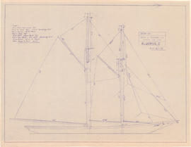
Drawing of the Bluenose II in full sail
Part of Oland and Son fonds
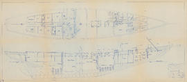
Drawing of the interior of the Bluenose II
Part of Oland and Son fonds
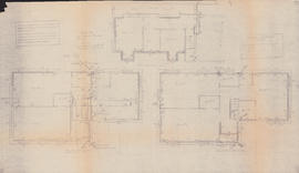
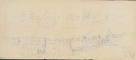
Heating plans for three floors of the Sheet Anchor
Part of Oland and Son fonds
Part of Oland and Son fonds
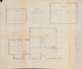
Heating plans for three floors of the Sword and Anchor Inn
Part of Oland and Son fonds
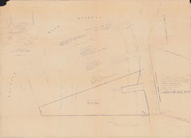
Land petition for property in Chester, Nova Scotia
Part of Oland and Son fonds

Floor plan of the kitchen at the Sword and Anchor Inn
Part of Oland and Son fonds
![A tribute to saints and legends who changed our world : [poster]](/uploads/r/dalhousie-university-archives/4/e/6/4e63bd81747e5111efefd38bf235f86cb921981963ea87cc02e8734f6266af14/MS-5-15_142.jpg)
A tribute to saints and legends who changed our world : [poster]
Part of Halifax Camerata Singers fonds
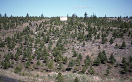
Photograph of a Christmas tree growing lot, Lunenburg County, Nova Scotia
Part of Bill Freedman fonds
Photograph of a Christmas tree growing lot, Lunenburg County, Nova Scotia
Part of Bill Freedman fonds
Photograph of a Christmas tree growing lot, Lunenburg County, Nova Scotia
Part of Bill Freedman fonds
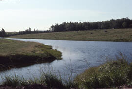
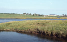
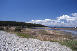
Photograph of the Goose Creek tidal pond, Lunenburg County, Nova Scotia
Part of Bill Freedman fonds
Photograph of the brackish Goose Creek tidal pond, Lunenburg County, Nova Scotia
Part of Bill Freedman fonds
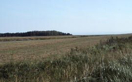
Photograph of a field near Goose Creek, Lunenburg County, Nova Scotia
Part of Bill Freedman fonds
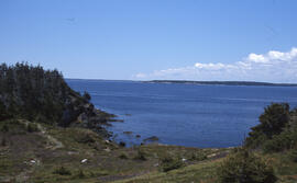
Photograph of the coastline along the Gaff Point trail, near Kingsburg, Nova Scotia
Part of Bill Freedman fonds
Part of Bill Freedman fonds
Photograph of the mouth of the Lahave River near the Gaff Point trail, near Kingsburg, Nova Scotia
Part of Bill Freedman fonds
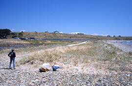
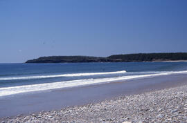
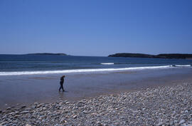
Photograph of Hirtle's Beach along the Gaff Point trail, near Kingsburg, Nova Scotia
Part of Bill Freedman fonds
Part of Bill Freedman fonds
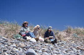
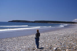
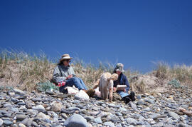
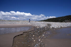
Photograph of two unidentified people and a dog on the Gaff Point trail, near Kingsburg, Nova Scotia
Part of Bill Freedman fonds
Part of Bill Freedman fonds
Part of Bill Freedman fonds
Part of Bill Freedman fonds
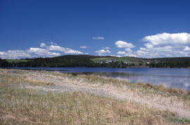
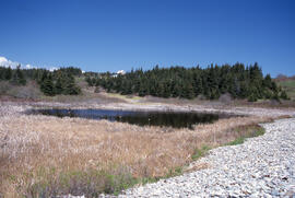
Photograph of Mosher's Pond along the Gaff Point trail, near Kingsburg, Nova Scotia
Part of Bill Freedman fonds
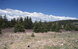
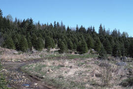
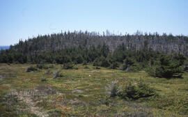
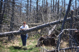
Photograph of forest areas along the Gaff Point trail, near Kingsburg, Nova Scotia
Part of Bill Freedman fonds
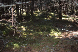
Photograph of understory along the Gaff Point trail, near Kingsburg, Nova Scotia
Part of Bill Freedman fonds
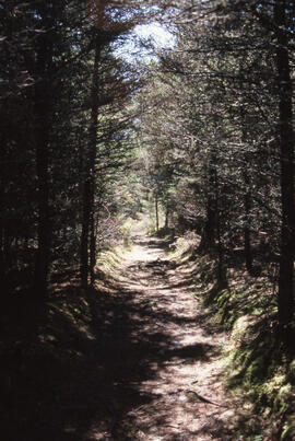
Photograph of a narrow tree-lined path along the Gaff Point trail, near Kingsburg, Nova Scotia
Part of Bill Freedman fonds
Photograph of understory along the Gaff Point trail, near Kingsburg, Nova Scotia
Part of Bill Freedman fonds
Photograph of forest areas along the Gaff Point trail, near Kingsburg, Nova Scotia
Part of Bill Freedman fonds
Photograph of Mosher's Island from the Gaff Point trail, near Kingsburg, Nova Scotia
Part of Bill Freedman fonds
Photograph of Mosher's Island from the Gaff Point trail, near Kingsburg, Nova Scotia
Part of Bill Freedman fonds
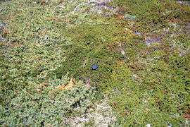
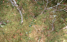
Photograph of mosses (with size reference) along the Gaff Point trail, near Kingsburg, Nova Scotia
Part of Bill Freedman fonds
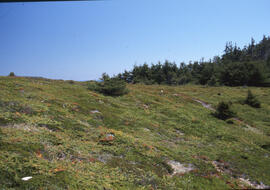
Photograph of forest areas along the Gaff Point trail, near Kingsburg, Nova Scotia
Part of Bill Freedman fonds
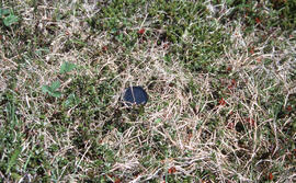
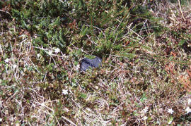
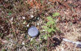
Photograph of heath (with size reference) along the Gaff Point trail, near Kingsburg, Nova Scotia
Part of Bill Freedman fonds
Photograph of heath (with size reference) along the Gaff Point trail, near Kingsburg, Nova Scotia
Part of Bill Freedman fonds
Part of Bill Freedman fonds
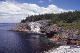
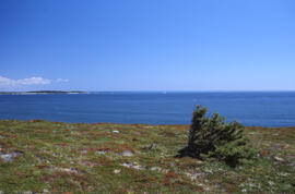
Photograph of rugged coastline along the Gaff Point trail, near Kingsburg, Nova Scotia
Part of Bill Freedman fonds
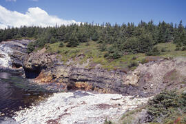
Photograph of rugged coastline along the Gaff Point trail, near Kingsburg, Nova Scotia
Part of Bill Freedman fonds
Photograph of fiddleheads growing along the Gaff Point trail, near Kingsburg, Nova Scotia
Part of Bill Freedman fonds
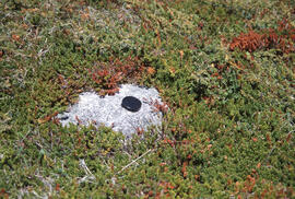
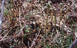
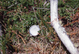
Photograph of heath (with size reference) along the Gaff Point trail, near Kingsburg, Nova Scotia
Part of Bill Freedman fonds
Part of Bill Freedman fonds
Part of Bill Freedman fonds