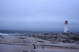
Wide-angle photograph of five unidentified persons standing on the rocks near Peggys Cove Lighthouse
- MS-2-789, Box 16, Folder 2, Item 19
- Item
- 2003
Part of Bill Freedman fonds
1233 results with digital objects Show results with digital objects
Wide-angle photograph of five unidentified persons standing on the rocks near Peggys Cove Lighthouse
Part of Bill Freedman fonds
Part of Bill Freedman fonds
Photographs of Voisey's Bay, Newfoundland and Labrador
Part of Bill Freedman fonds
Photographs of vegetation in barrens and bogs of Nova Scotia
Part of Bill Freedman fonds
Photographs of the Postville and Michelin Lake areas of Labrador
Part of Bill Freedman fonds
Photographs of the flora, fauna, and buildings on Sable Island, Nova Scotia
Part of Bill Freedman fonds
Part of Bill Freedman fonds
Photographs of the Arrow oil spill, Chedabucto Bay, Nova Scotia
Part of Bill Freedman fonds
Photographs of the Amoco Cadiz oil spill, off Brittany
Part of Bill Freedman fonds
Photographs of tailings sites around Sudbury
Part of Bill Freedman fonds
Part of Bill Freedman fonds
Photographs of small experimental oil spills sites around Tuktoyaktuk, Northwest Territories
Part of Bill Freedman fonds
Part of Bill Freedman fonds
Photographs of glyphosate spraying at Brier Island, Nova Scotia
Part of Bill Freedman fonds
Part of Bill Freedman fonds
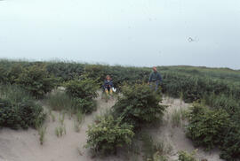
Photographs of Gaff Point, Lunenburg County, Nova Scotia
Part of Bill Freedman fonds
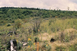
Photographs of forest regrowth in the Tobeatic Wilderness Area, Nova Scotia
Part of Bill Freedman fonds
Part of Bill Freedman fonds
Part of Bill Freedman fonds
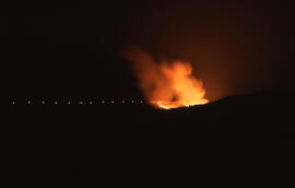
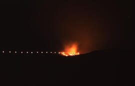
Photographs of Canadian forest fires
Part of Bill Freedman fonds
Part of Bill Freedman fonds
Part of Bill Freedman fonds
Photograph showing uncollected logs and foliage at an unidentified central Nova Scotian site
Part of Bill Freedman fonds
Photograph showing the pouring of molten slag at Copper Cliff, near Sudbury, Ontario
Part of Bill Freedman fonds
Photograph showing the pouring of molten slag at Copper Cliff, near Sudbury, Ontario
Part of Bill Freedman fonds
Part of Bill Freedman fonds
Photograph showing stemflow at an unidentified central Nova Scotian location
Part of Bill Freedman fonds
Part of Bill Freedman fonds
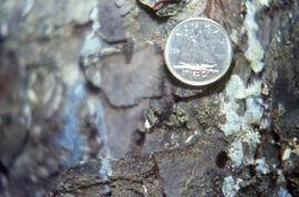
Photograph showing size scale of spruce budworm exit hole
Part of Bill Freedman fonds
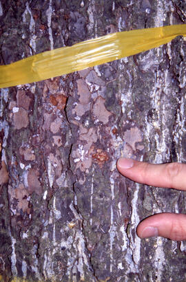
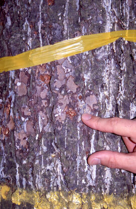
Photograph showing severe resinosis in spruce budworm-infested tree
Part of Bill Freedman fonds
Photograph showing scenery between the Richard Lake and Coniston sites, near Sudbury, Ontario
Part of Bill Freedman fonds
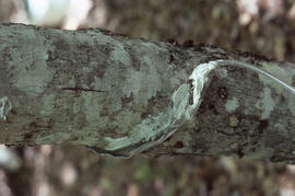
Photograph showing resin flow under a full canopy, Point Pleasant Park, Halifax, Nova Scotia
Part of Bill Freedman fonds
Photograph showing regrowth at the Meadow summer spill site, near Tuktoyaktuk, Northwest Territories
Part of Bill Freedman fonds
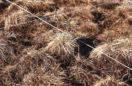
Photograph showing regrowth at the Meadow control site, near Tuktoyaktuk, Northwest Territories
Part of Bill Freedman fonds
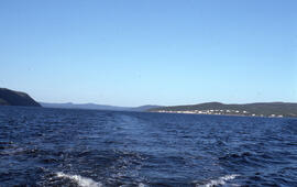
Photograph showing Postville, Newfoundland and Labrador from the middle of Kaipokok Bay
Part of Bill Freedman fonds
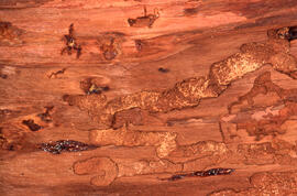
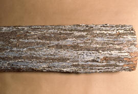
Photograph showing larval galleries of spruce budworm in Picea rubens
Part of Bill Freedman fonds
Part of Bill Freedman fonds
Part of Bill Freedman fonds
Part of Bill Freedman fonds
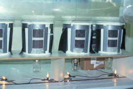
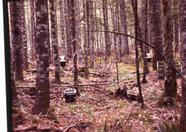
Photograph showing Canadian Forest Service rearing chambers
Part of Bill Freedman fonds
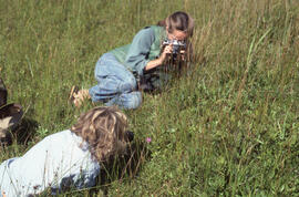
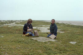
Photograph of Zoe Lucas and Noreen Stadey photographing grasses on Sable Island
Part of Bill Freedman fonds
Photograph of Zoe Lucas and Noreen Stadey in the "Rose Bowl" on Sable Island
Part of Bill Freedman fonds
Photograph of Zoe Lucas and Noreen Stadey harvesting sandwort on Sable Island
Part of Bill Freedman fonds
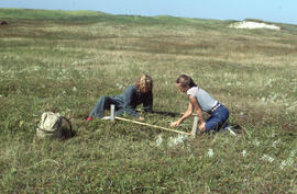
Photograph of Zoe Lucas and Noreen Stadey constructing a small enclosure on Sable Island
Part of Bill Freedman fonds
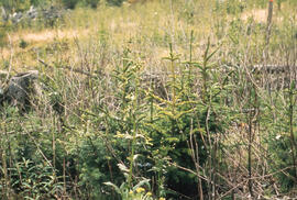
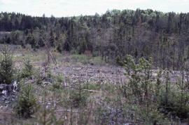
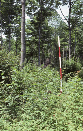
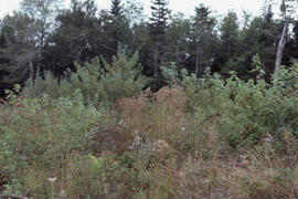
Photograph of young spruce regeneration at the Antrim site, Halifax County, Nova Scotia
Part of Bill Freedman fonds
Part of Bill Freedman fonds
Part of Bill Freedman fonds
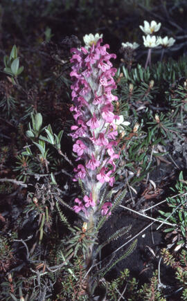
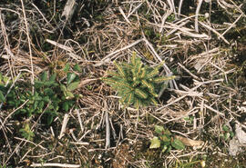
Photograph of Woolly lousewort (Pedicularis kanei) near Tuktoyaktuk, Northwest Territories
Part of Bill Freedman fonds
Photograph of woolgrass (Scirpus cyperinus) at the "Reggae" biomass site
Part of Bill Freedman fonds
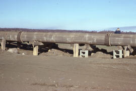
Photograph of wooden tailings pipes at the Copper Cliff site, near Sudbury, Ontario
Part of Bill Freedman fonds